Laos: A Captivating Beauty and Motorbikers Paradise

  1. Why to Go to Laos?
  2. First Thing First: How to Get into Laos
  3. First Destination in Laos: the Kong Lor Cave and Spring River Resort
  4. Pakse and Four Thousand Islands
  5. Exploring Nong Khiaw
  6. Luang Prabang: the Old Capital and Ultimate Destination in Laos

Why to Go to Laos?

The chances are great that you have never been to Laos, the only landlocked country in the Southeast Asia which is bordered by Vietnam, Thailand, Cambodia, Myanmar and China.

Lacking the sea and tropical beaches, Laos attracts much fewer tourists than the neighboring countries. Yet, on my various trips I met a number of fellow travelers who praised Laos’ amazing and varied landscapes, boat trips on the legendary Mekong river, Buddhist sites, exceptional food, and – most importantly – culturally diverse but universally hospitable people. And so, in December of 2022, I decided to check it out for myself.

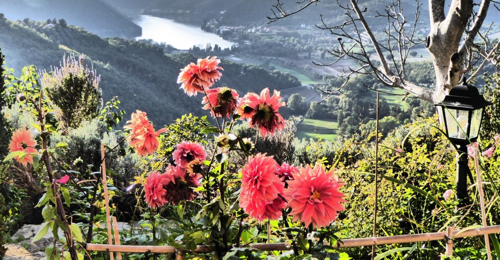
Laos: pristine nature and plenty of lakes…

Let me share with you a few facts the history and culture of Laos so that you would better understand the local context. But if not interested, then simply skip this section and move forward.

Laos traces its history to the kingdom of Lan Xang which existed during 13th-18th centuries and was one of the largest states in Southeast Asia. Eventually, Lan Xang broke into three separate kingdoms – Luang Phrabang, Vientiane, Champasak – and in 1893 all three came under a French rule becoming France’s “protectorate” and being united into what is now Laos. Apparently France had little interest in Laos and invested little in its economy or culture. Rather it simply kept the political control because the territory of Laos was a gateway to entire French Indochina Laos gained autonomy in 1949 and full independence in 1953 becoming a constitutional monarchy under king Sisavang Vong. Almost immediately, a civil war began between Communist resistance movement supported by the Soviet Union and the monarchy which, in turn, was backed by the United States.

During the Vietnam War, the territory of Laos was used by the Northern Vietnam and Viet Kong guerilla fighting against Americans as a place to hide, re-group and keep their supplies. In pursuit of Viet Kong, from 1964-1973, the US Air Forces made more than 580,000 sorties and dropped more than 2.5 Million tons of bombs on Laos – equal to plane-load of bombs every eight minutes – making Laos the most heavily bombed country per capita in human history. If interested, here is an excellent story called Living on Bombs which depicts the impact of this long-ago bombing on today’s life in Laos.

A “Bomb Village” in Northern Laos: old bomb shells are utilized as construction material
A fisherman boat made out of a fuel tank of B52 bomber

After the war, in 1975, the Communist party (Pathet Lao) came to power with military and economic aid from the Soviet Union. Until today, Laos remains one of the world’s few Socialist states openly endorsing Communism. The only legal political party is the Lao People’s Revolutionary Party. What has changed though is the “big brother:” instead of former Soviet Union, China has now huge political influence on Laos and controls the bulk of Laos properties and economy.

Presently, the major trade-asset of Laos economy are…its waters. When traveling in Laos, you will see beautiful lakes and rivers everywhere, but the country’s plentiful water resources and mountainous terrain also enable it to produce and export large quantities of hydroelectric energy to the neighboring states.

Stretching for about 650 miles (1,050 km) from northwest to southeast, Laos roughly consists of three geographical areas: north, central, and south. These three zones coincide roughly with three different landscapes: forested mountains, upland plateaus/foothills and lowland plains.

Laos: mountains near Vang Vieng in the north
Laos: foothills areas
Laos: lowland plains

Various ethnic groups living in Laos are also often categorized by their distribution by elevation: lowlands, foothills and mountains. The principal inhabitants of the lowlands are ethnic Lao. They constitute more than half of the country population and are the politically and culturally dominant people of Laos. They belong to the Thai linguistic group and migrated to the present day Laos from China in the first millennium CE.

Lao people

In the central parts live the mid-slope Laotians collectively known as Lao Theung. They constitute about 30% of country’s population with Khmu people being the largest group among them. They belong to Mon-Khmer linguistic group and were the indigenous inhabitants of present-day Laos.

Khmu: the “first people” of Laos

Finally, the highland Laotians are known as Lao Soung and account for about 10% of the population. They include a variety of minority cultures and tribes who lived historically in cultural isolation in these most remote and difficult to access regions of Laos. Among them, most known are the Hmong. That is for political reason as they were accused of supporting US troops during the war in Vietnam and were later heavily persecuted by the Communist government of Laos.

Hmong family

The bottom line is that being a relatively small country, Laos yet offers travelers a great diversity of experiences: both in terms of its nature, landscapes and local cultures.

First Thing First: How to Get into Laos

In order to travel in Laos, citizens of most countries need a visa which could be obtained upon arrival in the country. However, this procedure can take a while, especially, when the que of people is long: the Laotian border guards and immigration service are not very efficient. My strong recommendation is to get an e-visa in advance online. Here is the link to application portal (you need to apply at least 5 days prior to planned arrival).

How exactly you will arrive into Laos depends, of course, on where you are coming from. Traveling from San Francisco, I found it much cheaper to fly into Bangkok, the capital of neighboring Thailand, rather than in Vientiane, the capital of Laos. From Bangkok, several air companies operate short (about one hour) flights to Laos with arrival to several Laotian cities: Vientiane, Luang Prabang and Pakse. The tickets for those flights are quite affordable (around $ 100), and if you are in a hurry, this is the way to go.

But I have chosen a more adventurous – and in my view more pleasant – option: traveling overland by the train. Several long-distance trains leave Bangkok daily with final destination in Nong Khai which is a border railway station in Thailand. Full information on these trains, their schedules, prices, how to purchase tickets, and what the borders crossing procedures are can be found HERE. My choice was an overnight train #25 with comfortable sleeping cars. It leaves Bangkok at around 20.00 (8 PM) and arrives to Nong Khai at 6.30 in the morning. The price for a second class car (first class was sold out) was something like $ 30

There is nothing special about Nong Khai border railway station (the final destination of #25 train) except that it has a couple of interesting exhibition rooms (don’t ask me why) devoted to the Thai royal family.

The borders separating Thailand and Laos at Nong Khai are along Mekong river. The so-called “Friendship bridge” connects both sides and serves as a border crossing point. When you arrive to Nong Khai, you will be approached by the numerous motor-rikshaws offering their services to take you across the bridge and even help with immigration procedures. Don’t, because there is a cheaper, more efficient and pleasant way to cross the bridge: to take another, old rickety train.

The whole ride across the bridge is only about 20 minutes, but it is quite pleasant: sitting by the open window and absorbing the scenery.

20 minutes train ride, crossing Friendship Bridge from Thailand into Laos
In the middle of Friendship Bridge, entering the Lao side
On the Laos side. To the right side, are checkpoints for those arriving by cars, motorbikes, etc.

The border station on the Laos side is called Thanaleng, and this is the place where you will go through all borders crossing formalities. Thanaleng is only about 20 km / 12 miles away from the Laos capital, Vientiane. Again, the chances are great that either local taxi drivers or motor-rikshaws would expect the train from Thailand and offer their services to take you to Vientiane. My advice is to not use them, but, instead, download the App which is called “Loca” and which is essentially a ride-share App for Laos (similar to Uber). Clearly, you need to have access to Internet on your phone in order to use it, but if you do, I found Loca drivers being very efficient and their prices (which you know in advance) very inexpensive. You can pay both by cash or connect your credit card to Loca App. And similarly to Uber, you can schedule a pick-up from a certain point in advance. I did it a day before and my driver was already waiting at Thanaleng station.

My destination was not Vientiane itself (not much to see there), but the Southern Bus station which is ironically situated on the northern outskirts of Vientiane but offers long-distance bus services to the southern part of the country.

First Destination in Laos: the Kong Lor Cave and Spring River Resort

Essentially, there are three ways to travel long-distance in Laos: by plane, train, and inter-city bus. All these options are inexpensive by European or American standards. Planes and trains are faster and more comfortable, but they connect very limited number of destinations. If you travel extensively in Laos (and unless you rent a car), you probably will take buses quite often. The bus companies vary considerably in the comfort, the speed and the chances of being on schedule. When you are already in Laos, best thing to do is to ask your guesthouse or hotel about various options, schedules and help to purchase the tickets. But if you need to buy bus tickets for Laos in advance from your home country, I suggest the online agency which is called 12GoAsia. They offer tickets for variety of transportation options (planes, trains, buses, minivans) and for a number of Southeast Asian countries, including Laos.

Anyway, when I arrived to Southern bus station, I had already my ticket for Kong Lor, the first destination in Laos. I also had some time before bus departure and went to a huge market which is right next to the bus station. Wow! It was an impressive selection of meats, seafoods, fruits, vegetables, and prepared foods.

The bus ride from Vientiane to Kong Lor (which is famous for its huge underground cave system) takes about 8 hours with a few stops for food and restrooms. The bus was pretty full, and most luggage was placed on the top and secured by the ropes.

My bus from Vientiane to Kong Lor

There are a few guesthouses in Kong Lor itself, but my choice was different: I stayed in the Spring River Resort. It is about 2.5 km / 1.5 miles away from the village, situated in the lush tropical forest, on the bank of the river with the gorgeous view of the surrounding mountains.

Spring River Resort near Kong Lor caves

The bungalows at Spring River Resort are simple (with bathrooms and showers in a separate building), but they are charming in this simplicity, very clean and designed in a way which feels like being part of surrounding nature.

A significant factor in decision to stay at Spring River Resort were the reviews of travelers who praised its restaurant. And my first dinner was five-stars: both in terms of food flavors and presentation.

The next morning, having breakfast on restaurant’s open terrace was almost like a meditative experience with full immersion into the nature and surrounding scenery.

Breakfast at Spring River Resort

The river at Spring River Resort goes straight to the Kong Lor underground caves. You can hire a boat which would take you “in style” to the caves. But I wanted to see the village of Kong Lor and also stretch legs after previous day spent on the bus. So, I started walking to the village, but then a group of young French folks on scooters and motorbikes catch up with me, stopped and asked if I want a ride to the cave. It sounded like a good opportunity to join them and to explore caves together and I said: “Yes, of course. Thank you!”

Now is time to explain why Laos is “motor-bikers’ paradise.” Somehow, it has become a very common practice to explore different parts of Laos by the scooters or small motor-bikes. That is, people go from one area of the country to another by plane or bus, but then rent a bike and travel locally for a few days on their own two-wheels. The rental services are abundant, prices very low (around $10 per day) and the bikes’ quality good (mostly Japan made). Clearly, you cannot take much with you and are exposed to the weather and “outside elements,” but the roads are decent and you have full freedom to explore the land at your convenience. Hence, being in Laos, I saw these motorized travelers everywhere: riding either solo or in sizeable groups.

In ten minutes, our “motorcade” arrived to a sandy bank of the river where the cave-guides were waiting for visitors.

So, what is it all about the Kong Lor Cave? Considered one of Southeast Asia’s geological wonders, it is approximately 7 kilometers / 4.5 miles long, running straight through the massive limestone karst mountains which surround the countryside. Once inside, the height of the cave ceilings is up to 100 meters / 300 feet. The cave has impressive stalagmites and stalactites. But most importantly, the Nam Hin Bun River runs through the cave at a good speed and making sharp curves. Hence, it is not only about visiting the cave, but also about taking an adrenaline-inducing ride on a boat which is artfully piloted through the cave by one of the local guides. We first walked along the river to the place where it enters the mountain.

Then, a little bit more of hiking inside the cave.

And then we arrived to the “harbor” where the boats were anchored.

The cave is not lit and the boat journey goes in nearly full darkness except the headlamps of the guides and tourists. In the middle of the cave, there is an option to get on the shore and walk around stalagmites and stalactites. This small part of the cave is illuminated by electrical lamps.

Approaching the other side and exit from the cave, we had a little unplanned adventure. The water level was low, and the river run dangerously through the stony rapids. We got out of the boats and drugged them through this portion of the cave.

I enjoyed the ride immensely, but it also felt good to be on the other side of the mountain and under the bright sunshine.

After a small break, sunbathing and beer drinking, we went back through the cave arriving safely to our starting point. The French fellows invited me to join them for some “post-cave party,” but the day and scenery were gorgeous and I decided to walk a little bit and explore the area. Back in Kong Lor village, I stumbled upon what was called “The Best One Restaurant.” It looked both humble and appealing, with tables set on numerous wooden bridges protruding in all directions. The effect of sitting there was like being in the middle of the field.

I ordered a glass of wine (being in a former French colony, it is relatively easy to find wine in a local restaurant) and Pad Thai. I do not know if indeed it was the really “Best One” restaurant, but the Pad Thai was outstanding.

Excellent Pad Thai at the “Best One Restaurant.”

The next day, I decided to go on a day kayak trip. This is an “easy and lazy,” yet very enjoyable option to spend time at Spring River. The resort offers kayaks, you paddle downstream (easy!), and then the resort arranges a truck to pick you up and bring back together with the kayak. On a sunny day, like I had, there is nothing better to do. The river is narrow and the scenery on the both banks is very close and well visible.

Occasionally I saw huge buffaloes lying in the water and hiding there from too much sun.

I also passed a few villages

Small children from these villages were playing in the boats and splashing in the river.

In couple of hours, I felt like being fully part of the river and was ready to continue my slow ride forever.

But then, unfortunately, the sign on the bank of the river indicated that my journey came to its end.

The truck was waiting and took me back to the Spring River Resort in no time. There was still plenty of time until the darkness. Wandering through the grounds of the resort, I found something what looked like a water tower. I climbed on top of it and enjoyed the view of the resort and its surroundings.

My last dinner at the Spring River Resort was another visit to the “culinary paradise.”

Stir fried shrimps, fried sweet potatoes, and vegetable soup

Big THANKS goes to my hosts and owners of the Spring River Resort: Thomas and Vicky. Thomas is an expat from Switzerland, while his cheerful wife, Vicky, is a native of Thailand. In the middle of tropical forest, they managed to create a place which offers a European-level comfort, cleanness and service. Most importantly, Thomas and Vicky do they best to help local villagers to get some income by employing them or by offering their services to the guests of the resort. If you decide to stay at Spring River Resort, you will find it on Booking.com or you can communicate with resort directly via website http://www.springriverresort.com

Thomas and Vicky, the owners of Spring River Resort

When I woke up early next morning, being ready for the next adventure, Vicky came to say “Good Bye” and gave me a bag with freshly baked cookies. This small food supply turned out be very useful on this day, as it was a day of very long ride: first to the city of Pakse and then to the Four Thousand Islands. But this is already another story.

A nice farewell gift: Vicky’s home-made cookies

Pakse and Four Thousand Islands

After couple days at Kong Lor and Spring River Resort, the next destination was Four Thousands Islands (or Si Phan Don in Lao language). Four Thousands Islands is an area in the very southern part of Laos, on the borders with Cambodia, where Mekong river widens and splits into many channels, thus forming an archipelago of numerous (“four thousands”) islands.

Mekong River between Don Khon and Don Det islands

Picturesque waterfalls and rapids created by the river between these islands is a main attraction for the visitors to Four Thousands Islands. But not only this. It is also a good place to enjoy the boat rides on Mekong (especially, by the time of sunset), to rent a bicycle and tour the islands (they are flat and some are interconnected by bridges). Lately, many guesthouses were built here (especially, on Don Det and Don Khon) and the area is now increasingly known as a good party destination.  Pakse is the closest of the bigger cities to the area, and the transfers to a particular destination or guesthouse on Four Thousand Islands are typically arranged by the tour agencies or guesthouses in Pakse. Pakse has an airport, but for me, traveling out of remote Kong Lor village, flying was not an option. Rather, from Kong Lor, I took a three-hours long ride on a back of a huge truck to the regional center, the city of Thakhek.

Traveling with locals from Kong Lor to Thakhek

In Thakhek, I changed for a more comfortable (but still full up to capacity) bus and traveled another 7-8 hours to Pakse. My transfer to Four Thousands Islands was arranged for the next morning, and I stayed a night in Pakse in the guesthouse called Nangnoi Guesthouse. I highly recommend this place: very quiet location but right in the city center, clean and comfortable rooms (some with hot showers and air-conditioning). And they have both private and dormitory style accommodations.

Nangnoi Guesthouse: a great place to stay in Pakse

But the greatest advantage of staying in Nangnoi Guesthouse is its owner: Bouthong. He and his wife not only provide excellent accommodations, but can efficiently arrange transfers, bus tickets for long-distance travels, help with car and motorbike rentals, give good advise on “how” and “what” to do in the area. In short, Nangnoi Guesthouse is a “one-stop” for everything in Pakse. If you decide to stay there, get in touch with Bouthong via WhatsUp: +856-20-96-707-470

Bouthong and his wife, the owners of Nangnoi Guesthous

I arrived to Pakse in the evening and was both hungry and tired. I also had plenty of Laotian food previous days and wanted something different. Very close to Nangnoi Guesthouse, there is a place called Dok Mai Lao Trattoria Italiana, an authentic Italian restaurant, with great selection of Italian dishes and wines. Also, while it does not look very appealing from the front door, it has beautifully decorated inner covered courtyard where most tables are.

Dinner in Pakse at Dok Mai Lao Trattoria Italiana

This restaurant is run by an Italian expat, a fellow named Corrado. He is always present there and happy to chat with his numerous and diverse patrons. I stayed until the restaurant was closed and afterwards we had great conversation (and plenty more Italian wine) about realities of life in Laos.

Corrado, the owner of Trattoria Italiana in Pakse

The next day, minivan arranged by Bhoutong has taken me down South by Hwy 13 to an intersection with a road leading to the village called Khinak. From this intersection, a local motor-rikshaw brought me to the landing on Mekong river where a boat was waiting to go across the river to the island of Don Som and to my accommodations, the Don Som Riverside Guesthouse. Two more fellow travelers were on the same boat and going also to Don Som Riverside Guesthouse: Veronique and Pasqual from Switzerland.

Myself, Veronique and Pasqual getting ready to take off

Crossing powerful Mekong was an adventure on its own, and in about fifteen minutes the Don Som Riverside Guesthouse came into view.

Approaching Don Som Riverside Guesthouse

Let me explain my choice of this island and this guesthouse. Vast majority of people coming to Four Thousands Islands are staying either on Don Det or Don Khon. They have a lot of guesthouses, restaurants, and are also a place where the “party action” is. But I wanted a quieter setting and more authentic experience of Laos. For this purpose Don Som island is an excellent choice. It has a few villages and is still mostly used for agricultural purposes. Don Som is lacking dramatic views of the rapids which attract visitors to Don Det and Don Khon, but I figured that I can always go there on a day trip, while staying overnight on pristine and undisturbed Don Som. Don Som Riverside Guesthouse is the only option to stay there, but it is a very special place.

The view from veranda of my bungalow across Mekong river was gorgeous

The owners of the guesthouse are a couple: the Dutchman Sander and his wife, local girl, Tanoi. They met on Sander’s trip to Laos, fell in love, married and decided to stay in Laos. They used Tanoi’s family property, expanded it and created Don Som Riverside Guesthouse. Since its inception, the guesthouse welcomed curious travelers from all around the globe. I was attracted to this place by the enthusiastic reviews both on Google maps and on Booking.com and decided to check it out.

During my trip, Sander was back in Holland and Tanoi was “in charge.” She teaches English in a school on the other side of Mekong and is typically away on weekdays coming back on weekends. In the meantime, her sister and the rest of family operate Guesthouse and they do it nicely. Despite the fact that the Guesthouse is small (just three bungalows) and in remote location, it offers visitors a nice selection of both European style and Laotian dishes. The food is cooked here “like at home for the family” and it is excellent.

First dinner at Don Som Riverside Guesthouse: Pad Thai and stir fried seafood

The next day, I planned to visit the two main islands: Don Det and Don Khon. There are several options of getting there and one – the best, in my view – is to hire a private boat which would take you there and bring back in agreed upon time. Tanoi has a lot of contacts among the locals and this was arranged quickly. The ride on Mekong river from Don Som to Don Det takes about 40 min and the journey offers great views. Veronique decided to join and splitting the price (about $50 both ways) made the entire trip very affordable. Upon arrival to Don Det, we rented bicycles and explored both islands which are connected by the bridge.

Exploring Don Det and Don Khon
The channel dividing Don Det and Don Khon islands

There are several places on Don Det and Don Khon to see the rapids and – formed by the rapids – waterfalls, but in my opinion the most dramatic are Li Phi Somphamit waterfalls on Don Khon.

Li Phi Waterfalls on Don Khon island

I was told that there is also a zipline which takes visitors on a ride above the waterfalls, but, unfortunately during my visit it was closed for reparation works.

Li Phi Waterfalls on Don Khon island

The other attraction on Don Khon are the remains of the first railway in Laos, the Don Det–Don Khon narrow gauge railway It was built by the French in 1893 to bypass the Khone Phapheng Falls and enable vessels, freight, and passengers to travel along the Mekong River. The best place to learn about this – quite impressive and challenging – project is on the South of Don Khon, near the place called “Old French Port.” A small open-air museum tells the full story of – not existing anymore – railway and offers a good insight into realities of the local life in the late 19th century.

Old locomotive on display in an open-air museum on Don Khon island

Also, from Old French Port, one can enjoy the view of the neighboring Cambodia.

After a few hours of cycling under the sun, we were sweating and needed some nice break. Luckily, there a cool place on Don Khon, where one can relax and take a swim in Mekong river: Khongyai Beach.

Khongyai beach on Don Khon island

And then we were hungry. Both Don Khon and, especially, Don Det have a lot of places to eat. But my hosts at Don Som Riverside Guesthouse recommended strongly one particular place: a guesthouse and restaurant called Mama Leuah (www.mamaleuah-dondet.com) owned by German expat named Lutz. The setting of Mama Leuah is very appealing with a nice river view, while the food (Laotian and German dishes) is diverse and very good.

After excellent meal at Mama Leuah: with Lutz, the owner

It was time for the boat ride back to Don Som and our guesthouse. We scheduled the return so that we can enjoy the sunset while being on Mekong. And it worked out beautifully.

Me and Veronique on the way back to Don Som Riverside Guesthouse
Sunset on Mekong river

The next day was planned to be a “lazy day:” reading, talking and chilling out.

A great place at Don Som Guesthouse to sit by the river and simply “enjoy.”

But, yet, one “adventure” was planned. I mentioned previously that the food served at the Don Som Riverside guesthouse is excellent. And this is for a good reason: Tanoi also offers professional classes of cooking Laotian dishes. The process begins from the visit (across the river) to the local market, selecting and purchasing all ingredients, step-by-step preparations, and, finally proper serving. One of the persons who stayed at the Guesthouse, was Karolina, a young lady from Poland. She was especially interested in learning more about foods of Laos and took cooking class with Tanoi.

Karolina and Tanoi: cooking class at Don Som Riverside Guesthouse

The results of this cooking class were plentiful and very appealing

Sticky rice, spicy sauce, string beans, Laotian version of omelet, and two mushroom dishes

Needless to say that not only Karolina, but everyone at guesthouse has “benefited” from the outcomes of the cooking classes.

Veronique and Karolina: the lunch resulting from cooking classes

Karolina was leaving the same day and decided to use a public ferry to the mainland rather than ordering a private boat. Out of curiosity, we accompanied her. There is no particular schedule for the ferry between Don Som and Khinak village on the other side of Mekong. It goes back and forth depending on demands of passengers.

I stayed one more night and left next day, early in the morning. Tanoi arranged a boat ride, prepared strong coffee and came to say “Good bye!” I loved my time at Don Som Riverside Guesthouse and – unless you are looking for a party place – would recommend it to anyone. You can book it on Booking.com or via WhatsUp: +856-20-97-921-099

Leaving Don Som Guesthouse

I took a truck which travels to Pakse couple times a day from Khinak village and was back in the city in the late morning. My flight to Vientiane, the capital of Laos, was later in the afternoon. There was plenty of time to visit again Trattoria Italiana and chat with Coronado and then enjoy a two-hour long massage. Spa offering massages (typically, one hour is only $10) are abundant in Laos, and Pakse was not an exception. My choice was the place called Pho Kham Massage and it did not disappoint. Then short ride to airport, and I was ready to say “Good Bye” to Pakse and Four Thousands Islands.

At Pakse airport

It is only about one hour flight to Vientiane, but it was already dark, when the plane approached the city.

Approaching Vientiane

I did not plan on exploring Vientiane (nothing interesting there). My sole purpose was to spend a night and catch next morning another plane to Luang Prabang, an old capital of Laos. But there is always place for a surprise. On Booking.com, I found accommodations called Sunset Mekong Apartments. The reviews were very good, the price right, and location convenient – close to the airport. Using again the Loca ride-share App, from Vientiane airport, I was there in the matter of minutes. The place did not disappoint. The apartment was sparkling clean and comfortable.

Sunset Mekong apartments in Vientiane

The apartments also had a balcony with a nice view on Mekong river.

Sunset Mekong Apartments in Vientiane

The surprise came, when I went out in search of some place to eat. Right next to apartments, there was a restaurant called “Moon the Night.” It was an all-included buffet-style seafood place with one interesting caveat: a huge variety of fish and shell-fish was offered to patrons uncooked along with cooking equipment (electric grill, oil cooker) and utensils. Essentially, the concept was: “Cook it for yourself and eat as much as you wish.”

Moon the Night: cook it for yourself restaurant

I joined the crowds (mostly multigenerational Laotian families) and enjoyed my only meal in Vientiane.

Exploring Nong Khiaw

My next destination was Nong Khiaw, a mountain town in north-central Laos. Situated on the Nam Ou river, it offers views of steep limestone cliffs and gives access to many activities: hiking in mountains, visiting various ethnic villages, taking boat tours, kayaking, exploring numerous caves.

The nearest big city with airport is Luang Prabang, an old capital of Laos. A number of companies offer inexpensive short flights (under 1 hour) from Vientiane to Luang Prabang, but bear in mind that all of them leave in the morning. From Luang Prabang it is 140 km / 90 miles to Nong Khiaw, and the actual driving time is about 4 hours. There is a public minivan leaving daily Luang Prabang for Nong Khiaw at around 10 am, but my plane arrived at around noon and the only option to travel the same day was to hire a private car with driver. My guesthouse in Nong Khiaw arranged it: $75 is not cheap (by Laotian standards), but given actual distance and my time constraints, it was a right choice. I arrived in Nong Khiaw at around 16.00 / 4 pm and checked into Arthith Guesthouse. For under $ 20, I had a huge room with hot shower, unlimited coffee and tea, and the balcony with excellent view of surroundings.

The view from my room at Arthith Guesthouse

As you can see, the Arthith Guesthouse is strategically located: right in the middle of the town and by the bridge connecting two parts of Nong Khiaw.

My corner room at Arthith Guesthouse

The guesthouse is owned by a cheerful lady named Eid. Always with a smile, she helped to arrange transfer, ticket back to Luang Prabang, and, most importantly, connected me with reliable local tour guides. If you go to Nong Khiaw, Arthith Guesthouse is a place to stay. You can reserve it on Booking.com or via WhatsUp directly with Eid: +856-20-97-007-603.

Eid, my host and owner of Arthith Guesthouse

After check-in, I still had couple of hours of daylight. The best thing to do was to hike for a sunset view from the observation point called Pha Daeng Peak Viewpoint. The hiking trail begins from the main road in the town, and it is well marked, as many people go there every day. Yet, it is slippery and steep: so plan your time accordingly. In my case, it has taken about one hour to arrive there, and I was rewarded with 360 degree view on Nong Khiaw and surrounding mountains. Clearly, being there by the time of sunset was an additional bonus.

Sunset at Pha Daeng Peak View Point

And then it was time for dinner. Eid suggested “Coco Home Bar and Restaurant” which is right next door to Arthith Guesthouse. I went there and was not disappointed. My first meal in Nong Khiaw consisted of two local specialties: seasoned dry riverweed (very tasty and crunchy) and fish larb: cooked river fish chopped and mixed with many herbs.

Riverweed crackers and fish larb

Long story short, I ended up eating at Coco Home Restaurant all three nights in Nong Khiaw. Not only food was tasty and nicely presented, but the restaurant’s owner, Sebastian, was a great fellow to talk to. An expat from Switzerland, he has an extensive knowledge of the local life, but from the perspective of a Western person. Which is always helpful for the travelers.

Sebastian, the owner of Coco Home Bar and Restaurant

And I also liked that Coco Home was an open-air restaurant, where patrons dine on covered verandas with the view on the river and mountains.

Coco Home Restaurant: both excellent food and views

The next morning, weather did not look good: it was windy and cloudy.

Weather in Nong Khiaw can change quickly

But the day – a combination of boat trip and hiking – was planned already, and by 9.00 I was on the river with a group of 5-6 people from various countries, who were on the same tour. In couple of hours, the skies cleared and by the time our boat arrived to the first stop – the village of Sop Keng – bright sunshine replaced clouds.

Near Sop Keng village

The first destination of a hike was Yensabai Organic Farm, a combination of a family compound, a farm, a coffeeshop, and a homestay. To describe this place: think about commune which attempts to live sustainably and be fully self-sufficient; a commune, where some members live permanently (extended Laotian family of the owner, a local man named Xay) and some members come-and-go (visitors from around the globe).

Some of people visiting and staying at the farm simply hang around, but most volunteer with various chores ranging from the work in the garden to baking pastries and serving coffee to the day visitors like our group was. If you like to learn more about this quite interesting place or go there, check out their website: http://www.yensabaiorganicfarm.com, yensabaifarm@gmail.com When we arrived to the farm, we found four girls – all from various countries – staying there and all seeming very happy.

Volunteers staying and working at Yensabai Organic Farm

Being properly recharged with the strong coffee in the farm, our group continued hike through the fields: the landscapes were truly captivating and welcoming.

Our final destination on this hike (overall, slightly more than one hour) were Tad Mook Waterfalls, a good place to relax, have a picnic lunch, and even go for a swim in a pool under waterfalls.

Tad Mok Waterfalls

And then we walked back to the boat fully enjoying and appreciating this great day.

Yet, the disappointing news expected us when we returned to the boat. The original plan was to continue travel to the town of Muang Noy which is known for its hand-weaving and textiles. But the water in the river was low and the captain decided to return back to Nong Khiaw. Nevertheless, it was a good journey. Back in Nong Khiaw, wandering around the town, I stumbled upon this massage saloon, decided to check it out and had an excellent two hours long massage.

A very good place for massage in Nong Khiaw

It was time for dinner and I returned to Coco Home Bar and Restaurant for another delicious meal: home-made and freshly backed vegetable spring rolls and stir fried shrimps with mushrooms and vegetables.

Home-made spring rolls and shrimps with mushrooms and vegetables at Coco Home Bar and Restaurant

The next day was a very special day. In introductory section of this post, I wrote about different ethnic groups living in Laos. One of them are “Khmu” people, the indigenous inhabitants of northern Laos. Comprising about 11% of Laos total population, Khmu are sometimes referred to as the “first people” of Laos to indicate their deep historic roots in this country. Twice a year, Khmu people in Laos have their national festival. At that time, a number of Khmu villages are selected to host celebrations and ceremonies. By chance, I happened to be in Nong Khiaw exactly on a day of such festival and luckily one of the Khmu villages hosting festivities was only about 20 km / 12 miles away from Nong Khiaw. Sure enough I went there. The first thing I saw on the side of the road, even before entering the village, was the man who was cooking something on an open fire and in a huge pot.

Full of ingredients and flavors, noodle soup is one of Laos specialties

As it turned out, this was famous Laotian noodle soup. Full of various ingredients and flavors, served together with numerous condiments, noodle soup is the most common road-side dish in Laos. It was morning and this fellow was essentially serving breakfast for those families who came – some driving long distances – from other villages to partake in the festival. Then two young girls in bright festive clothes approached me and led to the village.

Khmu girls in traditional clothes

The procedure of joining the festival was walking through the gates, giving some (purely symbolic money), and drinking a small glass of Lao-Lao, a strong Laotian moonshine. I followed, of course, all requirements.

Entering Khmu festival

The first thing which I saw were some men sipping something through the bamboo straw from several vessels which appear to be full of some grain. It was a young, semi-fermented, slightly sweet rice-wine.

Young, semi-fermented rice wine is popular drink in Laotian villages

I was invited to join and the experience was fairly pleasant.

Right next to this “wine-stand,” three men performed some sort of music using instruments which were not familiar to me. The music was not exactly to my liking, but definitely added to the overall atmosphere.

Another activity – mostly popular with children – was a board game similar to dart. When I approached the crowd, I discovered one more non-Laotian person at this festival: the tall fellow was – similarly to me – the tourist, a Romanian living in the USA.

In an hour or so, everyone gathered around village square and the dancing performance began. To me, it was the best part of the festival. Bright clothes, various age of dancers, elaborated performance: the show was great.

Dancing performance at Khmu festival

Predictably, each festival – and village festival in particular – has “eating part,” and this was not an exception. Under huge tent, dozens of tables were placed. Each table has some assortment of pre-arranged dishes. But in addition, the families sitting at the tables have also brought their own supplies.

I, and my fellow Romanian traveler, were invited to join one table and we did without hesitation. I enjoyed pretty much everything from the table, except one item: apparently, Khmu people also eat rats, but I decided to avoid this particular dish.

After about one hour, it was clear that the eating will probably last until the end of the day, and I decided to leave. One more destination was waiting. On the way back to Nong Khiaw, I visited Pha Thok (also known as Pha Kuang) Caves. The caves are on the side of the mountains and in order to visit them you need to climb several long flights of stairs.

A bridge leading to the entrance into Pha Thok caves
The stairs leading to Pha Thok Caves

The effort to come to the caves pays back. In addition to impressive stalagmites and stalactites accompanied by the view on surrounding valleys, the caves also host a museum of Viet Kong resistance movement. Indeed, during the war in Vietnam of 1964-1973, they were used by the Northern Vietnamese partisans as a base and hideout place.

Inside Pha Thok caves

When I exited caves and returned to the floor of valley, it was almost sunset time. No one was around and the sense of serenity and peace was overwhelming.

The valley near Pha Thok caves

Back in Nong Khiaw, I went to say “Good bye” to a person who arranged all my activities during these two days. Thong, a young local man, has recently started his own tour agency and I wish him all the best possible luck.

Thong, the owner of Nam Ou adventure tour

If you will visit Nong Khiaw and need a good guide or any tourist service, go to Thong. Here is his contact – via WhatsUp- information:

Nam Ou Agency, a good place for any tourist services in Nong Khiaw

The last order of business this day was another tasty supper at Cocon Home Bar and Restaurant. This night, before parting with Sebastian (the owner), I had a flavorful mushroom soup and roasted vegetables.

Roasted vegetables and mushroom soup at Coco Home restaurant

Next morning, I left Nong Khiaw and headed (by public bus) to the last destination in Laos: the old capital city of Luang Prabang. But I knew already that I will be back in Nong Khiaw, as I liked very much the town, surrounding nature, and people who live there.

Luang Prabang: the Old Capital and Ultimate Destination in Laos

If someone’s trip to Laos would be limited to just one destination, then it should be the city of Luang Prabang. Literally meaning “Royal Buddha Image,” Luang Prabang was the capital of the Kingdom of Laos until Communist regime took over in 1975 and moved the seat of government to Vientiane. Located on a peninsula formed by the confluence of the Nam Khan and Mekong River, the historical center of Luang Prabang was recognized in 1995 as a UNESCO World Heritage Site. Its unique and remarkably well preserved architecture, religious sites and cultural traditions emerged from a blend of historical developments over several centuries, including the French colonial influence during the 19-20th centuries. Luang Prabang remains religious capital of Laos: numerous Buddhist temples and monasteries are intertwined with city’s visual appearance and everyday life. But it is not only religion and history that draw here visitors and make Luang Prabang a desirable place to live for many expats: the city has vibrant street life, interesting art galleries, colorful markets, gourmet restaurants, and much more.

Luang Prabang

Choosing where to stay in Luang Prabang is important for overall experience of being there. On the one hand, the historical center will give you a sense of being part of the city’s vibrant life. On the other hand, however, the hotels on one of the major streets can be noisy. My recommendation is to book a hotel or guesthouse on Khem Khong street which is also an embankment of the Mekong river. It is only 2 blocks away from the main road bisecting the city, but is much quieter and with many trees creating a relaxed and visually appealing atmosphere.

My choice was “Apple 1 Guesthouse.” I found it on Booking.com, liked the reviews (also good reviews on Google maps), and booked their very best room (private bath, air-conditioning, small balcony, refrigerator) for about $35 per night. And it was a good investment. Not only location and accommodations were good, but the owners were genuinely welcoming and helped with all local arrangements: tickets, restaurants, finding a driver to take me out of Luang Prabang, and much more. Big THANKS goes to Jimmy (a Laotian, who grew up in Australia) and his wife for my time in Luang Prabang.

With Jimmy and his wife, the owners of Apple 1 Guesthouse

After settling in Apple 1 Guesthouse, I went out for both a walk and something to eat. Joma Bakery on main street attracted my attention. Inside, there was a great selection of pastries and sandwiches, but I was sold on a very good looking pumpkin pie.

Joma bakery: a pumpkin pie to die for

With a sizable piece of pumpkin pie, I walked back to the embankment of Mekong river and settled in DaDa Cafe which offers a variety of coffees grown in Laos: both for tasting and purchase.

DaDa cafe has tables right by the river and this is where I enjoyed my – equally excellent – pumpkin pie and coffee.

Lunch with the view on Mekong river

After lunch, I walked along the Khem Khong road (the embankment) until the place where Nam Khan river flows into Mekong river. It is a good walk to see examples of the houses built in French colonial epoque.

French colonial architecture on Khem Khong street

Besides old mansions, there was one more reason for walking on Khem Khong street. At its very end, at the confluence of Mekong and Nam Khan rivers, there is a rickety bamboo bridge across the latter. Walking on it was fun.

Bamboo bridge across Nam Khan river

Most importantly, from the other side of the bridge, one can get a good view of two rivers’ merging with one another.

Nam Khan flowing into Mekong river

As noted, Luang Prabang is full of Buddhist temples and monasteries. The first one that I visited was Wat Pak Khan which is very close to the bamboo bridge. I heard bell ringing and wanted to find out what the reason was. As it turned out, young – really children – Buddhist monks were practicing the art of bell ringing under supervision of a senior priest.

Young Buddhist monks practicing bell ringing

No one was inside of Wat Pak Khan main temple, and I sat there for a few minutes enjoying cool air, peace, and solitude.

Wat Pak Khan Monastery

Very close to Wat Pak Khan, there was another monastery: Wat Khili. It hosted an interesting photo exhibition depicting various meditation practices. I spent about one hour there looking at the pictures made in different times and in different locations, but all on the same subject: meditation.

Photo exhibition devoted to meditation at Wat Khili monastery

Walking along the Sakkaline Road, the main street of Luang Prabang, you will see a lot of Buddhist temples and monasteries. I visited a few of them and my two favorites – in terms of both architecture and overall atmosphere – were Wat Xiengthong and Wat May Souvannapoumaram.

A place which you inevitably will visit while in Luang Prabang is Phousi Hill. Accessible from the very center of the city by hiking and climbing several hundreds of stairs (not very difficult though), Phousi Hill offers sweeping 360 degree view on Luang Prabang and its surroundings.

The view from Phousi Hill on Luang Prabang

Also, another “must visit” site on Phousi Hill is a huge (something like 2 meters long) Buddha’s Footprint. Check it out:

Buddha’s Footprint on Phousi Hill

Walking back, down to the city, I saw this plank affixed to the trunk of tree and thought: “Indeed, this is a very good point:”

A must visit place in Luang Prabang is its colorful night market. This is definitely best place – in terms of variety of choices and prices – to buy various souvenirs and folk crafts.

Shopping for arts and crafts at Luang Prabang night market can be easily combined with dining under the stars. Numerous vendors cook and sell all possible kinds of foods, while dozens of tables are put right on the street in the middle of market and offer comfortable and casual sitting.

Night Market in Luang Prabang

My favorite food stall was the one offering a variety of vegetarian dishes for about $1.5 per plate.

Vegetarian Buffett at Night Market

One more tip for people who visit Luang Prabang and look for a bottle of a good wine. Very close to the night market, there is a store called Mekong Minimart. It has very unassuming appearance, and inside you will find a typical selection of a “little bit of everything.” But go to the back of the store. Beyond glass door, there is a real wine cellar: a huge selection of wines from various countries are on display and available for purchase for a very affordable price. I never found out the origins of this “secret wine cellar:” it appears that some bottles were smuggled into Laos without paying custom taxes, etc. Bottom line is that it is great place to shop for wine in Luang Prabang.

Wine cellar at Mekong Minimart

I like sparkling wines and bought several bottles of Cremant de Bordeaux.

$12-15 per bottle: not a bad price

If you have more than one day in Luang Prabang, you must go to see (and possibly swim in) the gorgeous Kuang Si cascades and waterfalls. They are about 30 kilometers / 20 miles to the south of Luang Prabang, and it takes about 1 hour by car to get there. Numerous tourist agencies in Luang Prabang offer inexpensive tours to the Kuang Si. The problem is that waterfalls are very popular among visitors and the place can be very crowded. The best time to visit is in the morning, no later than 9.00, before the buses with tourists began to arrive.

In order to do so, you either need to rent a scooter/motorbike or hire a private driver to take you there. I opted for the second option and it was not very expensive: something about $40. We arrived at around 9.00 to the park, parked the car, paid entrance fee and boarded small electric train which has taken us to the beginning of hiking trails connecting various waterfalls. But before coming to waterfalls, one more attraction awaits you: the sanctuary of Black Asian bears.

They are small (like big dogs), very cute and it is a lot of fun to watch them.

Black Asian bears at Kuang Si waterfalls

And then, past Black Bears’ sanctuary, a chain of interconnected cascades and waterfalls begins. Assuming that there are no (or very few) other visitors, this place is a truly visual paradise.

My understanding was that there is no prohibition on swimming at Kuang Si waterfalls, and I decided to give it a try.

The experience of swimming at Kuang Si was great: very refreshing and also it felt like being in a natural jacuzzi.

Swimming in Kuang Si waterfalls

Unfortunately, by 10 am, the waterfalls park was already full of visitors and we headed back to Luang Prabang. One more attraction awaited us along the road: the buffalo farm which produces ice cream and variety of cheeses made out of buffalo milk. To the best of my knowledge, this is the only place in Laos, where domestic cheese is made.

I did not care much about the ice cream, but wanted to taste their cheeses and went through the entrance gates inside the farm.

Buffalo farm

A nice lady, Susie, an expat from Australia and the head of the farm, met and greeted me and offered to take on a formal tour of the farm. But my time was limited, and I simply asked about cheese tasting. A plate with samples was brought to the table in covered gazebo and I ended up buying a few – vacuum packed – pieces of buffalo feta which was my favorite. All in all, very cool place to visit and to learn about its history and future plans. If you are interested or will plan visit there, here is farm’s website: http://www.laosbuffalodairy.com

Selection of cheeses at Buffalo Dairy farm

This was my last full day not only in Luang Prabang, but also on a trip to Laos. For the final dinner, I wanted something special. My choice was a restaurant called Tamarind: it is a combination of a cooking school and restaurant. The food served there is made out of locally sourced products, and the dishes are Laotian by origin, but with various interesting innovative “tweaks.”

Tamarind has several sample menus with assortment of the small portions of various dishes, and I have chosen a vegetarian set. The whole experience: the knowledge of servers, flavors of food, presentation of dishes were excellent and I only regretted that I cannot return tomorrow.

Sample menu of Laotian dishes at Tamarind restaurant

The next morning, I needed to be at the airport at around 9.00. There was still time for one more experience which is the “specialty” of Luang Prabang: the daily alms giving ceremony. Every early morning (before sunrise), Buddhist monks from the various monasteries walk through the streets of Luang Prabang collecting alms – the food donations offered to them by the locals and visitors. 

Daily alms giving ceremony in Luang Prabang

My plane to Bangkok (there are several direct flights from Luang Prabang) left on time. In Bangkok, I changed for a flight to Frankfurt, Germany. The air-company was Qatar Airways which was awarded a designation of the “Best Air-Company of 2022.” It was Christmas eve: the plane was pleasantly empty, and even in economy class the service was top-notch with stewards serving Champagne and very decent food.

This was the end of two-weeks long trip to Laos, but I knew already that I will be back to this country – the country of diverse nature and cultures, but universally hospitable local people.

  1. Why to Go to Laos?
  2. First Thing First: How to Get into Laos
  3. First Destination in Laos: the Kong Lor Cave and Spring River Resort
  4. Pakse and Four Thousand Islands
  5. Exploring Nong Khiaw
  6. Luang Prabang: the Old Capital and Ultimate Destination in Laos

A Week in the Second Smallest African Nation: Sao Tome and Principe

My trip to Cabo Verde in December 2021 was a great success. And I decided to check out another former Portuguese colony in Africa: Sao Tome and Principe. An island nation, it is located off the western coast of Central Africa and right on equator. In fact, many tourists to Sao Tome make a point to travel to this geographic divide, and take a picture while standing on equatorial lane with two feet being in two different hemispheres. As the name suggests, the country consists of two islands: São Tomé (main island) and Príncipe (much smaller in size) which are about 150 km (93.21 mi) apart. On my trip, I visited only “bigger brother,” the island of Sao Tome.

With the territory of 1,000 sq kilometers (386 sq miles) and population of just above 200,000 São Tomé and Príncipe is the second-smallest and second-least populous African nation after Seychelles.

The islands were uninhabited until their discovery by Portuguese in the 15th century. Gradually settled, they first simply served as a center for the Atlantic slave trade. Later on, thanks to the rich volcanic soil and proximity to the equator, São Tomé and Príncipe developed lucrative plantation economy producing sugar, coffee and cocoa. Today, the ruins of many “rocas” (former plantation estates) are popular destination for visitors to Sao Tome. Here are a few which are worth checking out: rocas of Agua Ize, Sao Joao de Angolares and Bombaim.

Full independence from Portugal was peacefully achieved in 1975. Today, São Tomé is widely regarded as a free democratic country with high level of political freedoms and freedom of speech. Bad news is that after gaining independence, in 1970-80s, Sao Tome was heavily supported economically by the countries of Communist block: with Soviet Union and Eastern Germany in the first place. As Communist system crumbled and Soviet Union broke apart, this support stopped. The centrally directed (“Communist style”) economy, with most means of production owned and controlled by the state, turned out to be inefficient. The country went into long period of economic stagnation and uncertainty. On a positive side, clealry, Sao Tome has great potential for tourism and it is a very safe and attractive country to travel.

The people of Sao Tome are predominantly of African and mestiço descent. The legacy of Portuguese rule is visible in the country’s language (Portuguese is state language, with French being also widely spoken) and culture which fuses European and African influences. The climate of Sao Tome is tropical: hot and humid. The rainy season is from October to May, and, in order to avoid it, I came here in June.

Speaking of “coming here,” most direct international flights connect Sao Tome with Portugal, Angola and Gabon. My choice was obvious: 4 hours flight from Lisbon by Tap Portugal. The first appearance of the country from the window of the plane was quite pleasant: it was some small island, part of Sao Tome archipelago, with a lighthouse on top of it.

We landed and the first impression was that the main international airport of the country looked very “humble.”

T took a picture, hurried to immigration officer, gathered luggage and in less than 30 min. was out of the airport.

First minutes in Sao Tome

A pre-arranged driver was waiting outside to take me to the first destination: a small resort, on the coast, 15 miles southeast of Sao Tome city which is called “Nge D’ Ai EE” or “Center D’Aqui Nge” (you can easily Google both names). It was dark and late, when I arrived, but the expertly prepared dinner was served and waiting: octopus Portuguese style – one of my very favorite dishes.

There were no other visitors this night at the resort, and the cute kitten made a great company through my dining al fresco (the restaurant is like a big open gazebo).

Next morning, on the same table, I found beautifully arranged “tropical breakfast” which was accompanied by the locally grown coffee. Speaking of the latter, coffee is an excellent choice to bring as a gift from Sao Tome.

After breakfast, I finally had a chance to meet and chat with the owner of the place: Celia. Celia is an expat from Portugal who has deep love for Sao Tome and is passionate to introduce visitors to its culture, nature and people. A successful businesswoman with international experiences of work and life, she discovered Sao Tome by chance a few years ago. On her first visit, Celia found and loved the sleepy coastal village of Agua Ize (where her resort was later built) and decided to stay there for a while. She “mingled” with locals (which is culturally not always an easy task), felt more and more “at home,” and, eventually bought property and settled there. Then she realized that by developing her property into a small resort, she can not only make some money, but also generate income for a local community by bringing tourists to this picturesque corner of the island and offering locals some jobs.

Celia, the owner of the Center D’Aqui Nge

If someone would ask me to describe Center D’Aqui Nge in just two words, I would say “humble and gorgeous.” “Humble,” because bungalows are comfortable but – by Western standards – simple (no air-conditioning or hot water). “Gorgeous”, because both property and surrounding nature are visually very appealing. Here are couple pictures from the grounds of the Center D’Aqui Nge.

Celia’s place is also right next to one of the most popular tourist attractions on Sao Tome: Boca do Inferno or Hell’s Mouth. Roca do Inferno is a product of coastal erosion by the ocean which resulted in strange rock formations, passages, and sea caves. When the waves hit shoreline, they funnel powerfully through these caves and vertical shafts and produce impressive fountains from the apertures of the shafts and mighty howling sounds. Unfortunately, when I was there, the sea was calm and I did not see the “show.”

Boca do Inferno

And one more “praise” for Center D’Aqui Nge. If you are a person with love for good local food, this is the place to be. Both Celia and her local employees can cook expertly, present dishes nicely, and take into account visitors’ requests and preferences. One of my greatest food “adventures on Sao Tome” was “calulu.” It is a hearty stew prepared with fresh or dry fish and shrimps. Other ingredients include okra, onions, tomatoes, eggplants, and finely chopped greens such as leaves of sweet potato or cassava. Cooking calulu is a long ordeal: it takes several hours. Hence, I was very pleased when Celia prepared this Sao Tomean delight. I know, the picture does not look very appetizing, but calulu was very tasty…

Calulu, the quintessential dish of Sao Tome

The first day I did not go anywhere and spent most time on a nearby beach called Praia Ize. Google maps give it only 3.9 stars, but I loved it. First, it is a truly local beach which is mostly used by the fishermen to launch their boats and it does not attract any tourists. Second, it is situated in a well protected cove: the waters are calm, shallow and warm.

Praia Ize

Third, the beach is wide and sand is fine and clean.

Finally, I love to observe the local social life and Praia Ize is a great place for this. Fishermen going in and returning form the ocean, village’ families having their picnics on weekends, or teenagers passing by on the way from school to home.

Early afternoon. Kids go home from the school.

In the early evening, little kids from the village started to show up and attempt to socialize with me regardless of linguistic barrier.

Sunset on Praia Ize

By the time of sunset, I returned home, but instead of taking shortcut through the village, made a small loop: walked to highway, along the road, and then back to Celia’s resort. While walking along the road, I saw first (but definitely not last) time the typical “laundry process” on Sao Tome. Clothes, beddings, everything were washed in creeks and streams. Just lake that:

Laundry process in Sao Tome

Most people come to Sao Tome first of all because of the beaches. And, indeed, there are plenty of them and they are quite different: some more accessible and some more remote; some with calm waters and some rather “wavy” being good option for surfers; some fairly deserted and some with bustling social life. And so, the next day was the day of beach hoping: checking out several of them, all along the East coast and to the South of Center D’Aqui Nge. First stop was Praia das Sete Ondas – the Beach of Seven Waves. This one is right next to the highway and attracts plenty of visitors. It also has decent bar/cafe.

Bar on Praia das Ondas

When I first arrived, it was right after the rain and the beach was deserted. But in one hour or so, the local young folks started to come in sizeable groups. Clearly it was one of these beaches with abundant social life.

Praia das Sete Ondas

Further South, the next stop was at Praia Micondo. I first saw it from the highway.

Approaching Praia Micondo

Praia Micondo requires a little bit (like half a mile) of driving or hiking on a dirt road. Not a big deal. For me, it was better than Sete Ondas: more private and nicely enclosed in the cove with calm water and surrounding lush vegetation. It looks that there were some fishing activities there, but definitely not recently. These boats and house appeared to be fully abandoned.

Praia Micondo

The last beach of the day was Praia Grande. You would need to make a little more effort to get there from the major highway. In fact, dirty road to it (about 1 mile) was built only recently. Prior to that it would be necessary to hike through the thick rain forest. Praia Grande was my absolute favorite. Wide, clean, scenic and fully deserted.

Praia Grande

The next day was rainy. The only option was to go to the capital, the town of Sao Tome, and check out a few local attractions and some shops. I walked from Center D’Aqui Nge to the coastal highway and waited for minibus which isthe main local public transportation. The minibuses on Sao Tome do not follow particular schedule. Typically, the driver at the station of origin waits until his bus is full or nearly full and then drives to final destination. People can get on and off at any place, but the problem is that often buses remain full all along the route and there is no way that they can take more passengers. This was my case. I waited for an hour, and a few minibuses passed by but none stopped. I ended up hitchhiking which was surprisingly easy. When I arrived to the town, it was around noon, and the streets were full of kids marching from the school back home.

Early afternoon in the capital of Sao Tome

I walked a little bit around and found two great shops. One was bakery called Padaria Moderna I love baked goods, pastries, etc., and this place had wide variety of choices, low prices, and excellent quality of everything what I bought there.

The second shop (and very close to Padaria Moderna) was place called Kua Tela. This is an ultimate destination for any type of handicrafts, souvenirs, and “eatable and drinkable” goods produced in Sao Tome. The prices are a bit higher than at the local producers, but then everything is nicely packed, the staff speaks English, and all what Sao Tome is known for can be found in one place. Physically, it is a rather small shop – just two rooms – but variety of products was impressive, and I spent nearly one hour looking, choosing and buying.

The shelves of Kua Tela store are full of local products and handicrafts

I wrote already that coffee production used to flourish on Sao Tome and – while no longer an important export item – it is still grown there. A fun place to go and to learn more about history of coffee in Sao Tome and to try some freshly prepared brew is “Monte Cafe.” It is old coffee plantation which offers a museum, guided tours, cafe and restaurant. It is located outside of Sao Tome city, in an attractive natural setting and also on the way to popular St. Nicholas Waterfalls. Instead of searching for minibus going in a right direction (which was somewhat challenging task), I simply nailed a taxi and negotiated a price to Monte Cafe. My understanding was that the cab will be for me only, but no. As we drove through the city and its suburbs, driver picked up more and more passengers. I ended up in a car with seven more persons. Here is my best attempt to take a picture of our joint ride.

Taxi “Sao Tome” style

Unfortunately, when we arrived to Monte Cafe a strong rain began. Hence, I did not have a chance to go on a tour through plantation or to continue hike to St. Nicholas waterfalls. But I enjoyed sitting in cafe and sipping hot aromatic coffee.

Monte Cafe: all about coffee in Sao Tome

When I returned to Sao Tome city, it was late afternoon, and the streets were full of cars, scooters and motorbikes: the rush hour began.

I walked through what is considered the central part of the city and along embankment facing the ocean. Neither were particularly appealing.

I found a bus station, spotted a minibus going in a right direction, and then simply waited for about 20 minutes until it was full of passengers

Waiting for minibus to be fully loaded with passengers and cargo

After three nights in Center D’Aqui Nge, the next destination was famous beach called Praia Piscina. I planned to stay there couple nights at a place called Gombela Ecologe. Praia Piscina is situated on the southwestern corner of the island. In order to get there from Center D’Aqui Nge, I needed to go around half the island. Instead of dealing with minibuses, I hired a local driver and used this private ride to see a few sites en route. The first stop was Cascata de Praia Pesqueira – a waterfall which drops into the ocean. It was nice, but nothing too special. Also, the scenery was a bit obstructed by a bunch of local ladies who used waterfall as an excellent spot for laundry.

Cascata de Praia Pesquires

But the panoramic view towards the ocean (with waterfalls being behind me) was truly spectacular.

Back on the highway and shortly after waterfalls, there was a big road-stand offering good variety of handicrafts made out of the local woods. The selection was impressive and prices quite decent.

And then the highway has sort of “disappeared” and the road became more like a country road. At this point, I was glad to be in a four wheel drive – not in the local minibus with – typically – quite bad suspension.

The Southern portion of Hwy 2 on Sao Tome

The speed dropped to about 20 miles per hour and suddenly the magnificent peak Cao Grande – the “postcard symbol” of Sao Tome – came into the view.

Cao Grande, the symbol of Sao Tome

The Pico Cão Grande (in Portuguese: “Great Dog Peak”) is a needle-shaped volcanic peak. Its summit is 663 m (2,175 ft) above sea level. Cao Grande was formed by magma solidifying in the vent of an active volcano. Although the peak rises only 370 meters (1,200 feet) above surrounding terrain, it is difficult to climb, because of the moist moss growing on the rocks and the presence of snakes. The first attempt to conquer Pico Cão Grande was made in 1975 by Portuguese climbers, but it was not until 1991 that a group from Japan finally succeeded. A few more miles and Porto Alegre – the southernmost fishing town in Sao Tome – appeared.

Porto Alegre

The highway 2 ended here and – without stopping in Porto Alegre – we drove a few more miles on a dirt track finally arriving to Gombela Ecolodge

Gombela Ecolodge from the distance
Main building and restaurant at Gombela Ecolodge

Gombela has just a few bungalows. They are simple but new and fairly attractive: both from outside and inside.

The lodge’s territory is sprawling, its grounds and plants are nicely “manicured, and the views are stunning. Combined with remoteness, the resulting vibe is a “small private paradise hidden in the nature.”

My favorite spot at Gombela ecolodge to spend lazy afternoon
Another good place at Gombela to have a picnic with ultimate view

As noted, Gombela is remote. That is, there are no nearby restaurants or shops. At least, not in a walking distance. But the good news is that the staff of the lodge can cook very well. There is no menu: you need to simply discuss (a bit in advance so they can get supplies) what do you want to eat and it will be prepared to your liking. One of their specialties is crab cooked in a curry sauce. I had it for dinner on first evening and it was delicious.

Crab curry, a specialty of Gombela Ecolodge

Breakfast is included in the price of accommodations and although the choices are limited (eggs, toast, marmalade, yogurt, etc.), I was fully satisfied with big plate of various fruits and a pot of local strong coffee. The breakfast was, of course, accompanied by a panoramic ocean view.

Breakfast at Gombela ecolodge

I feel that at this point the reader may ask: “Okey. It is a beautiful place with good food, but is this the main reason to stay at Gombela?” The answer is: “No.” The main reason to spend here couple days is Praia Piscina – the “Pool Beach.” Essentially, Praia Piscina is indeed like a pool which is filled with ocean water, but separated from the sea and waves by the natural wall made of stones and rocks. Surrounded by lush vegetation and clean white sand, it is both very picturesque to see and fun to splash around. And it is right next to Gombela.

Praia Piscina: a natural pool in tropical paradise

If you decide (and you should) to visit Praia Piscina either with a day trip or staying at Gombela, pay attention to the tides. When it is high, the pool is full and great for swimming. But when the tide is low, it is more like a puddle. I was lucky to be there at the high tide and enjoyed Praia Piscina to the fullest.

High tide is a good time to be at Praia Piscina

I stayed two nights at Gombela, but then it was time to say “Good bye!” My big thanks goes to Eajir, who is an on-site manager of the lodge: a very attentive and kind host. If you decide to book Gombela directly (not via Booking etc.), here is Eajir’s cell phone which is on What’s Up: +239-993-4585

Eajir and myself: last minutes at Gombela

Returning from Gombela, I decided yet to try the minibus option. The starting point for the one running along the east coast in north direction was in Porto Alegre. Eajir promised arrange transportation to the bus station and I was not worried. Yet, it was a surprise when – instead of the car – a young fellow came on a light motorbike. First, I was not sure how all my luggage (a suitcase, small backpack, another bag) can be transported. Second, I remembered bumpy dirt trail (from coming to lodge by car) and was somewhat apprehensive of navigating this trail on a heavily loaded motorbike.

My “limo” chauffeur from Gombela to Porto Alegre

Well, the ride was not exactly smooth, but surprisingly efficient and even fun. All three pieces of the luggage and myself were delivered safely to the spot in the town where locals were waiting for minibus.

Nothing is exactly on time in Sao Tome, and – while waiting for the bus – I had plenty of time to observe the street life in this dusty fishermen town. Perhaps, most touching and somewhat troubling, was to see small children helping their families in various heavy chores. Like this small fellow drugging tree trunk.

The sight of working children is common in Sao Tome

Finally, the minibus came. It filled up to capacity and beyond with passengers and luggage, and I was on my way to the destination of this day. Remember, at the beginning of this post, I mentioned “rocas” – old plantations with once stately mansions which are popular destinations for many tourists. While most rocas are in the conditions of decay and dilapidation, a few have been restored and offer visitors upscale accommodations with “colonial ambiance.” Among most known, is Roca de Sao Joao de Angolares.

Roca de Sao Joao des Angolares

The main reason to come here are actually not accommodations as such, but famous multi-course lunches and dinners prepared by Chef Joao, a former cooking show celebrity from Portugal. The description of their meals sounded interesting (creative “fusion” style dishes, made with locally grown ingredients, farm-to-table supply) and I decided to give it a try. Plus, food is served on open terrace with the view of ocean and tropical forest.

Roca is located in the town of the same name (Sao Joao de Angolares), but a bit up the hill from the coast. I booked dinner at roca, but choose to stay in a small hotel-restaurant called Mionga which was right next to the highway and also very close to a local beach. The reviews on Google maps praised Mionga for genuine hospitality, good accommodations with much lower price than at roca, and (!) also outstanding restaurant with owner, Nelitu, being also a main chef. When I arrived in early afternoon, the place was jam-packed with tourists who came here specifically for lunch. The view from restaurant was great and food looked delicious. In fact, I nearly regretted that my dinner is already booked at roca.

The room was also very good: spacious, clean, and nicely decorated.

My room at Mionga Hotel

I had a few hours before dinner at Roca de Sao Joao dos Angolares and walked to the nearby village beach. It was surprisingly clean (no empty bottles, beer cans, cigarette butts), and I decided to stay for a while: to take a swim and also observe local social life.

A good beach near Mionga hotel

In about half an hour I was rewarded with the free sport show: the local guys played soccer and did so quite masterfully.

And then I felt asleep on a warm sand until strange sounds woke me up. A bunch of pigs came to the beach and were “roaming” around strange lying object – me.

It was getting dark and it was time to go for my fancy dinner at Roca Sao Joao de Angolares. Fast forward, dinner was Okey, but it did not live up to expectations which were based on numerous praising online reviews. I guess it was one more reminder that while traveling it is not a good idea to have any preconceived notion of what we will get or see. Otherwise, the chances of disappointment would be great. On one hand, the service at the dinner was impeccable and the “story” of each dish was interesting. On the other hand, however, some of dishes were fairly boring in terms of flavors, portions were very miniature, and the number of courses smaller than promised. While being somewhat disappointed with food, I greatly enjoyed conversation with Ivan, the manager at Roca Sao Joao de Angolares. A native of Angola, he spent some time studying in former Soviet Union and developed a taste for classic Russian literature. Hence, we ended up discussing virtues of novels and personages by Fyodor Dostoyevsky, Leo Tolstoy, etc.

Ivan, manager at Roca Sao Joao de Angolares and literature connoisseur

I woke up early next morning at Mionga hotel and walked downstairs for breakfast. The restaurant was absolutely empty (I was the only overnight guest) and brightly lit by the sun.

Morning at Mionga hotel and restaurant

But the kitchen was busy already: Nelito and his son were getting ready for the coming lunch crowds. I thanked them for hospitality and comfort, and promised to be back for an abundant meal at their restaurant (which I missed this time).

Nelitu, the owner and chef at Mionga hotel, and his son

This was my last full day at Sao Tome. I returned to Celia’s Center D’Aqui Nge and spent most time on a nearby beach.

My last sunset on Sao Tome: low tide, calm waters, and sleepy village of Agua Ize

I asked Celia to cook dinner and decide herself as to what would it be. Somewhat predictably, for this “last supper,” she has chosen my favorite octopus Portuguese style. And I still had a bottle of an excellent dry Riesling made by my German friend, Helmut Darting, a winemaker and owner of vineyard in Pfalz.

Last dinner on Sao Tome.

Seven good days on Sao Tome were over. Will I be back? Perhaps, but may be not: there are always new countries to go. Point is that I was very grateful to everyone who made my time there interesting, rewarding, comfortable, and meaningful. Big thanks goes to Celia, Ejair, Nelitu, Ivan and many other people whom I met in Sao Tome.

Cabo Verde: a Dream for Exploring Tropical Islands

I bet you never heard of Cabo Verde: did you? Also known as “Cape Verde,” it is an archipelago and a country in Atlantic Ocean close to African coast. It consists of ten – amazingly different in terms of landscapes – volcanic islands. They are situated  between 600 to 850 kilometers (320 to 460 nautical miles) west of Senegal and have the total population of about 500,000. The islands were uninhabited until the 15th century, when Portuguese sailors discovered and colonized them.

Thanks to geographic position en route to Americas, Cape Verde played key role in the Atlantic slave trade. But its location attracted not only merchants: the islands also became a heaven for pirates and the so-called “privateers” (essentially, maritime mercenaries). For centuries, various races and ethnicities (mostly Black Africans, Portuguese and French) blended with each other and evolved into a very distinct Creole culture and population. Today, Portuguese is the language of government and instruction in the schools, while the Cape Verdean Creole is an equally recognized national language. To make it clear, Creole is spoken by the vast majority of population, but several attempts to create its universal written form have essentially failed.

In terms of culture, Cabo Verde is probably not “famous” for the literature or fine arts, but people here are well known for their musicality which incorporates African, Portuguese and Brazilian influences. The quintessential national music style is morna, a melancholic and lyrical type of song. The other local music styles are coladeirafunaná and batuqueCesária Évora, the “Queen of Morna,” was the world-known Cape Verdean singer. Nicknamed the “barefoot diva,” she liked to perform barefooted on stage.

Formerly a Portuguese colony, Cape Verde achieved full independence in 1975. Since the early 1990s, it has been a stable representative democracy and one of the most developed and democratic countries in Africa. Lacking natural resources, national economy is largely dependent on remittances from the Cape Verdean diaspora community. In fact, Cabo Verdeans living across the world outnumber significantly the inhabitants on the islands. In the USA, big pockets of Cabo Verdean communities are to be found in several towns in Boston area.

What else a prospective traveler to Cabo Verde should know? The violent crime is virtually non-existent here and the same is true about various “natural dangers:” no poisonous snakes and no need for vaccinations when traveling to Cabo Verde. Country’s warm tropical climate is milder than that of the African mainland, because the surrounding sea moderates temperatures. The islands also do not receive the upwelling (cold streams) that affect West African coast. As a result, the air temperature is cooler than in nearby Senegal, but the ocean is warmer. The islands generally have little precipitation and – except three moderately rainy months (August, September, October) – the chances of visitors to enjoy sunshine and warm sea waters are close to 100%. Of ten islands, two have become a prime “beach destination” for package-style vacations and most tourists: Sal and Boa Vista. And this was exactly why I did NOT go to these islands.

During three weeks in Cabo Verde, I explored four islands which form southern part of the archipelago: Fogo (a “volcano and wine” island), Brava (a “hiker paradise” island), Maio (a “forgotten beach” island), and Santiago (capital Praia, lush vegetation, and beautiful mountains),.

First thing first: how to travel to Cabo Verde? The country has three international airports: in capital Praia (Santiago island), and on Sal and Boavista islands (with many charter flights arriving there). Predictably, as a former Portuguese colony, most frequent flights to Praia are from Lisbon and this is how I flew there. The first image of Praia from the air was quite appealing.

Capital Praia from the air

With more than 150,000 inhabitants, Praia accumulates about one-third of the entire country’s population, and it is quite sprawling by the territory. The best area to stay in Praia is the so-called “Plateau” – a naturally elevated part of the city with nice pedestrian streets, many restaurants and cafes, governmental offices, etc. I was lucky and found an excellent AirBnB (right in the middle of Plateau) which is run by a cheerful young couple: Suelly (she is teacher of English) and Ildo (he is a personal trainer). Their three-story house has several rooms and a roof-top terrace, and they also offer travelers a lot of small yet essential services: personalized guided tours, transportation through the island, etc. You can find Suelly’s place on AirBnB site (look for “Solo Traveler in the Heart of Praia”). Or, simply walk there, knock on the door, and ask for accommodations. The address is Rua Serpa Pinto 40, Praia.

Traveling between various Cabo Verde islands, I stayed several times in Praia and always with Suelly and Ildo: one really cannot wish anything better.

Suelly with her daughter

I had only one full day in Praia and simply walked around and explored Plateau part of the town. The national presidential palace is nice but fairly humble

Right next to the palace, I found a Catholic church (over 80% of Cabo Verdeans are Roman Catholics) with service in progress. Due to COVID restrictions, some people were listening to the mass sitting outside, and I joined them for a while

Praia has many street markets. The most famous (and by far the largest) is Sucupira market. Because of diversity of people and goods sold there, Sucupira Market is also known as the “Portrait of Cabo Verde.” Even if you are not big on shopping, it is definitely worth visiting and exploring.

Plateau area also has its own, much smaller but well stocked, market. And this was the place where I did most of the grocery shopping.

Next day, I was planning to go to Fogo island and then some unplanned adventures began. There are two ways of traveling between islands. The first option is by air. Except Brava and Santo Antao, all islands have small airports which are served by domestic flights (for tickets, look at http://www.bestflycaboverde.com). The second, more adventurous and much cheaper, option is by taking ferry boats which are operated by the ship company called CV Interilhas (www.cvinterilhas.cv). CV Interilhas is notorious for being inevitably off schedule: departures and arrivals times can be delayed by the hours. But I was not in a hurry and wanted to travel as the locals do. Problem was that by time of my arrival to Cabo Verde all CV Interilhas’ ferry boats (there are just three of them) were broken and non-operating. I was told that this does not happen very often (good news), but no one knew when the ferry will resume its service (bad news). Interilhas’ website did not offer any information or updates. When I visited in-person central office, the distressed employee was wildly guessing and said: “May be in a day, or two, or a week…” With limited choices, I bought air ticket (about 40 Euro) for a flight to Fogo. The departure was at around 6 am and, except few passengers traveling with me, the airport was nearly deserted at that time.

Just a few passengers on flight from Praia to Fogo

By the way, “flying to Fogo” is not exactly correct description. The plane essentially takes off, ascends up to certain altitude, and almost immediately begins landing. The whole thing lasts only about 30 min. And here I am: welcome to the airport of Sao Felipe, the capital of Fogo island.

Fogo Island: Volcanoes, Wine and Black Sand Beaches

Fogo (Portuguese for “fire”) is 26 km long and 24 km wide, and it has a population of about 36,000. Rising to 2,829 meters (9,281 feet), active volcano, Pico do Fogo, is Cabo Verde’s highest point and the major attraction for visitors to Fogo. The whole island is essentially a stratovolcano that has been active frequently and recently: it last erupted in 1995 and 2014. In the middle of the island is Bordeira, a nine-kilometer-wide (5.6 mi) caldera with walls of one kilometer (0.62 miles) high and a breach in its eastern rim. The road through this breach which connects inside of caldera and the rest of the island. Why someone would need a road inside of volcanic caldera? Because two villages, Portela and Bangaeira, exist on the floor of the caldera and form together a community Chã das Caldeiras with about 700 inhabitants. The perseverance of the residents of Cha das Caldeiras is amazing. During last two eruptions, both villages were destroyed and people were evacuated. Yet, both times they returned back and rebuilt homes. There is no running water or electricity in Chã. The locals use generators to light and power their homes. The rainwater is collected and stored in large cistern tanks.

Inside of caldera: volcano Pico de Fogo.

I will tell more about the trip to Cha das Caldeiras a bit later. But first – a few words about Sao Felipe, the capital of Fogo. It was founded in the 16th century and has a nice historic city center (called Bila Baxo) which is on the tentative list of World Heritage Sites. Sao Felipe is known for colonial architecture: many houses have colorful and richly decorated façades, wooden balconies, or bay windows. About 50 mansions are the so-called sobrados – the town-houses dating back to Portuguese colonial epoque. Featuring typically two floors with a wide balcony, the sobrados were the residences of the notable and rich people. And I ended up staying in one of these – nicely restored – sobradas. Looking through the various AirBnB options, I found a place called “Casa Beirmar.” It had very positive reviews from the guests was run by the “superhost” named Mustafa. Casa Beirmar had two floors, several rooms and apartments, and huge balcony overlooking ocean. But during the stay in Sao Felipe, I was the only guest in this sprawling mansion.

Casa Beirmar, my home in Sao Felipe

As it turned out, the owner of Casa Beirmar, Mustafa, is somewhat of a legendary person on Fogo. A Turk by origin and devoted mountain climber by passion, he lives and works mostly in Western Europe. But he also has family and sizeable tourist business on Fogo. I communicated with Mustafa via WhatsUp, asked him many questions about the island, and before long it felt like talking with an old friend. Big THANKS goes to Mustafa for his numerous tips and insights into life on Fogo. Upon arrival to Casa Beirmar, I was greeted by the cheerful housekeeper Camilla who takes care of all guests staying at Casa Beirmar.

Me and Camilla, the housekeeper and great cook at Casa Beirmar.

Speaking of Camilla, when you stay at Casa Beirmar, there is no need to go to restaurants: Camilla is an outstanding cook. You tell her what type of food you like and then simply let her create a very “personalized” dish. I told Camilla that I like fish, fruits and vegetables (but no rice or potatoes, please) and here is my dinner plate which looks more like an artwork.

One of Camilla’s culinary creations

Casa Beirmar is right next to an old Catholic Church – “Igreja Nossa Senhora da Conceicao.”

The parish community seems to be very active. Nearly each evening the Church had worship services accompanied by a choral singing which I enjoyed sitting on balcony of Casa Beirmar.

Across the square in front of the church and to the left of Casa Beirmar, there is an excellent seafood restaurant called “Pensao e Restaurante Sea Food.” One night Camilla was unable to cook and I ordered from this restaurant my very favorite: grilled octopus.

Casa Beirmar is also very close to the town square of Sao Felipe. I enjoyed daily walking through this small but very appealing “plaza.”

Main Town Square of Sao Felipe

Even outside of the small historical center, the streets of Sao Felipe are fairly appealing and the houses are often painted in various bright colors.

One of the residential streets in Sao Felipe

On first day on Fogo, I visited “salinas.” “Salinas” is a coastal area on the north of Fogo (about 20 km from Sao Felipe) where black lava formed a series of ledges and arches. There is a viewing platform to walk around and a black sand crescent beach. Several blowholes inside of the rocks spray salty water which then dries out into white sparkling salt: hence, the names “salinas.” It is also a good and safe area for swimming. Lava created here many natural pools which are protected from ocean’s waves and currents. The trip to salinas from Sao Felipe by taxi costs about 30 Euro and it is well worth it. The landscapes along the coastal road were impressive.

On the way from Sao Felipe to salinas

No one was at salinas when we arrived. I spent about one hour exploring rock formations and even took a short swim.

And then a local fisherman came and began sorting out his catch of the day. When I approached, he was busy “butchering” a sizeable moray eel – another seafood specialty of Cabo Verde.

Salinas are often recommended to tourists as a perfect place for swimming on Fogo, but there is a much better option in a walking distance to Sao Felipe. The town has a big commercial port for ferries and cargo ships, but just a few hundred meters from it, there is a much smaller fishermen’s harbor. It is protected from the ocean by a solid wall with a small opening for boats to go in and out. During the day, there is little traffic and almost no boats there. The water is clean, calm and warm: think of the huge swimming pool filled with ocean water. While in Sao Felipe, I went there each day for a couple of hours of sunbathing and swimming.

Fishermen’s harbor: great place for swimming near Sao Felipe

Next to this protected pool, there is also a huge black sand beach. During several days of staying in Sao Felipe, I did not see a single tourist on that beach. On the picture below, there is a white building in a distance and on the slope of a mountain. This is Fogo’s prison. It looks that local inmates have truly astonishing view over the ocean.

It was time to visit the community of Cha das Caldeiras: to climb volcano, to explore villages in caldera, and drink locally produced wine (yes!). When traveling on Cabo Verde islands, most common option is “aluguer” – the minibuses which travel in different directions. Sometime there is a definite schedule for various destinations, sometime aluguer leave when they are filled with passengers going in the same direction, and sometime you can pay extra to driver so that he would take you to a particular spot. Regardless, traveling on aluguer is always fun as your “rub shoulders” with locals and observe everyday life from the window of a minibus.

After about two hours on the road, we arrived to the “official entrance” to Cha das Caldeiras

From there, the road begins to slowly climb up: the floor of caldera and villages are at the elevation of 1700 meters/5200 feet.

Road to Cha das Caldeiras

Some portions of the road are literally cut through lava.

Road to Cha das Caldeiras

And finally we were inside of caldera with the prime view of volcano Pico de Fogo

Some people come to Cha das Caldeiras only with a short day visit, but it is definitely worth to spend there one or two nights. Even if you do not plan on hiking and/or climbing volcano, simply staying in this unworldly lunar landscape is a unique experience. After last devastating eruption of 2014, the enterprising inhabitants of Portela and Bangaeira villages have not only returned to Cha and restored their houses, but also built a number of accommodations for tourists: small pensions, hostels, etc. Most of them are fairly simple, but there is one nearly luxurious option. Remember my “AirBnB friend” Mustafa – the fellow who owns Casa Beirmar in Sao Felipe? Well, his wife Marisa and her family are from Cha das Caldeiras and they operate by far the best hotel in caldera: “Casa Marisa 2.0” (www.fogo-marisa.com).

Marisa, the owner of “Casa Marisa 2.0”, and her daughter

Casa Marisa has fine restaurant, main hotel’s building, and nicely landscaped courtyard.

But I would say that the major “drag” of Casa Marisa are several “funcos” – comfortable bungalows which – from the outside – replicate traditional Caboverdian houses that originate from Africa.  Funco houses have circular form, their walls are made of rocks and stones, while conical thatch roof was traditionally made of palm fronds. Truth to be told, Casa Marisa offers quite upscale versions of “funcos:” they are very spacious, have hot showers, WiFi and even roof-top terraces. I stayed in this one.

After arrival, I still had a few hours of sunlight and went on a hike exploring the area inside of caldera. Amazingly, some plants and even flowers have managed to grow out of volcanic lava and ashes.

These red flowers are locally known as “Christmas flowers.”

I saw a few traditional “funco” houses, but probably not nearly as comfortable as the one which I had at Casa Marisa.

Traditional “funco” house in Cha das Caldeiras

But most people here live in even simpler houses like this one.

Shortly before sunset I climbed on the slope of the hill to get a better view of the entire area and both villages on the floor of caldera: Portella and Bangaeira.

And then there was time to head back to Casa Marisa. This evening, Mustafa arranged for me a special experience: tasting local wines which are produced by the agricultural cooperative of Cha das Caldeiras. Why the wines are produced in such unlikely place as a volcanic crater? Here is an answer. In 1870, a Frenchman, the Count of Montrond (François Louis Armand Fourcheut De Montrond) stopped on Fogo on his way to Brasil. He liked the island and stayed on Fogo until the end of his life. Montrond brought from France the vines and kicked off wine production in the caldera. He also produced coffee and exported it to Portugal. Today, many of the inhabitants of Chã das Caldeiras have light skin, blond hair, blue eyes, and the same family name: “Montrond.” They all trace their ancestry back to the biologically prolific Count of Montrond.

In terms of climatic conditions, because of the high altitude, Chã das Caldeiras has milder temperatures and greater precipitation than other areas of Fogo. Hence, local people manage to grow here a variety of fruits and vegetables: apples, grapes, quince, pomegranate, figs, peaches, tomatoes, beans, corn, etc.

Apples of Cha das Caldeiras

Many villagers make wine for the private home-consumption. The local agricultural cooperative buys excess grapes from the farmers and produces commercial white, red, rosé, and passito wines (all labeled “Chã”); and also grape, apple, quince, and peach distilled spirits (labeled “Espírito da Caldeira”). Chã das Caldeiras is the only area in entire Cape Verde that grows significant quantities of grapes and produces export-quality wines. When I came back to Casa Marisa, an impressive table was set under the stars with samples of all wines and spirits produced by Associação dos Agricultores de Chã (Chã Farmers Association). Quite appropriately, the name of the person who presented wines and explained various details was Eurico Montrond.

Tasting local wines at Casa Marisa.

Fogo island is also known for soft goat cheese. Small cheese-heads are round shaped and wrapped in banana leaves. This cheese is produced by a number of people, and sold at markets, restaurants and shops. My dinner at Casa Marisa that night consisted of expertly prepared seafood (some mollusks I never tried before), fresh goat cheese, and a bottle of aromatic white Cha wine.

The next day began early. At around 6.00 am (to use cool part of the day), I headed to “conquer” volcano Pico de Fogo. Some people do this hike and climb on their own: it is possible and doable. But having a local guide has many advantages not only in terms of finding best ways to get to the summit, but also learning along the way about local culture, nature, and many other things. My guide (and I can highly recommend him to everyone) was younger brother of yesterday’s “wine guide:” Flavio Montrond. The hike to the top of volcano is not difficult. Taking it slowly and with some breaks, we were at the top in about 4 hours. The views from the trail are quite impressive, especially, after ascending above the level of the clouds.

And then, at the top, you can take a look inside of a crater.

A few more steps, and the view opens towards the other side – in opposite direction from which we came.

And here is part of the hike where the real fun begins. Instead of returning back to caldera the same way, we started run down – better say “jump down” – on this fairly steep side of volcano. The thing is that this slope is covered with the thick layer (two-three feet deep) of soft volcanic ashes. Each jump lands you comfortably in the natural “feather bed.” In about 20 minutes (versus 4 hours of ascend), we were back at the base of volcano. Here is the slope which we just “jumped” down.

One more hour and we were back at Casa Marisa. I was about to say “Good Bye” to Flavio, but he suggested to go to “Casa Ramiro” for a glass of “Manecom.” What is “Casa Ramiro” and what is “Manecom?” Casa Ramiro is a local establishment and a little bit of everything: an informal cultural center where the locals meet, a bar, a shop, a small museum, and, most importantly, a place where men and women get together to play music and sing. What is “Manecom?” It is actually Chã’s best-known wine. Unlike commercially produced “Cha”-labeled wines, Manecom is house-made red wine. Many households make Manecom: both for sale and personal consumption. The sweet and strong in alcohol variety is by far the most popular. We sat with Flavio outside Casa Ramiro, drank Manecom, and talked about living in Cha das Caldeiros.

Flavio Montrond, my guide to the summit of Pico de Fogo

It was getting dark and Flavio went home, but I stayed at Casa Ramiro a bit longer. First I looked at various artifacts: music instruments used by locally famous musicians, old photos depicting life in Cha das Caldeiras, etc.

And then, one by one, local men came with music instruments and very informal but lovely jam session began.

An impromptu music night at Casa Ramiro

I came home late, but Marissa, the owner of Casa Marissa, and her young daughter were waiting for me to say “Good night and good bye,” because I was planning to leave early next day.

Marissa, the owner of Casa Marisa, and her daughter

Next day, I wanted to be in Sao Felipe in the morning, but aluguer wouldn’t go until the mid of the day. Not a big deal. Through my “wine guide,” Eurico Montrond, I found a perfect private ride with local girl named Carla. It turned out that Carla is newly appointed chief wine-maker at another winery situated near Sao Felipe: Vinha Maria Chaves.

Being originally from Fogo, Carla received her professional training in Portugal. She had all chances and options to stay there, but, instead was passionate about making good wine in Cabo Verde. Honestly, “Cha” wines which I tried in caldera were Ok, but nothing special to write home about. I asked Carla to show her winery and she gave a “grand tour.” We also tasted her first (not bottled yet) wines. Hands down, Carla’s wines were the best of all that I tried in Cabo Verde.

Carla, wine-maker at Vinha Maria Chaves. For best Cabo Verde wines, look no further.

I was on Fogo island already five days and wanted to go to the next destination, the island of Brava – the smallest and least visited of all Cabo Verde islands. Problem was that there is no airport on Brava and there was still no word from CV Interilha about when ferry service would resume. But when I woke up next morning, the local tour agency called and informed that the ferry would arrive to Fogo in a few hours and proceed further to Brava: this is how many things function in Cabo Verde. I bought ticket and rushed to the port just in time. The process of “checking-in” luggage looked somewhat suspicious. The passengers simply gave their suitcases or backpacks to the men on several trucks and told them to which island they go. No receipts and no luggage tags.

Checking-in luggage for ferry to Brava

Then we went through the gates and boarded – hopefully properly repaired – ship.

The weather was perfect and I stayed on the upper deck.

On ferry from Fogo to Brava

It was time to say “Good Bye” to Fogo – the island of volcanoes, black sand beaches, wine and, most importantly, many good people who helped me to discover Fogo in the best possible way.

Brava Island: Hiking Paradises, Secret Beach, and House with “Million Dollar View”

After about three hours on ferry boat from Fogo, Furna, the main port on Brava island, came into view.

Town of Furna, main port of Brava

Brava (Portuguese for “brave” or “wild”) is the smallest of all Cabo Verde islands. It has total population of just about 6,000 and the territory of 67 square kilometers / 26 square miles. Cabo Verdians describe Brava as the “greenest” and “most mountainous” island. Most visitors to Cabo Verde don’t even think about traveling to Brava arguing that “there are no beaches there” and “there is nothing to do on Brava.” Both assertions are totally wrong in my view.

Brava was discovered in 1462 by the Portuguese explorer Diogo Afonso, but few people lived there until 1680. This was the year when Brava received many refugees from Fogo after its volcano erupted and covered the island with ash. Frequent pirate attacks forced the population to move to the interior of the island, where the capital town of Nova Sintra was founded around 1700.

The nicest place to stay on Brava is Fajã de Agua which is a small harbor village on the west coast. Backed by the steep mountains and wide open towards the ocean, Faja de Agua has very appealing vibes of being secluded, but, at the same time, spacious and welcoming. This was my first glimpse of Faja de Agua when I arrived by taxi from Furna.

Faja de Agua

Essentially, the whole village is stretched along one road which parallels the ocean. Each day I walked this road and enjoyed the calm and peace of Faja de Agua.

A few accommodations are available for tourists in Faja de Agua. My ultimate choice was “Kaza di Zaza” (www.kazadizaza.com) – a place which describes itself as “the Capeverdean dream of Dutchmen Erick Mulder.” Eric, a professional boat builder from the Netherlands, settled on Brava about 15 years ago.

Eric Mulder, the owner of Kaza di Zaza

Eventually, he created a compound consisting of three houses: all built on the slope of the mountain and one above another. Here is the picture of the entire Kaza di Zaza: the main white two-story house, smaller yellow bungalow up and to the left, and, finally a very simple hut up and to the right. All three places are available for visitors.

The main house has a shady adjacent terrace with tables and benches.

My choice of accommodations, however, was very simple upper hut.

It has a light bulb, but no running water or power outlets. There is, however, a small outside kitchen with propane stove and an outside solar heated shower. Water supply comes from a huge cistern under the house.

My home at Kaza di Zaza

This shack was perfect choice for me: always fresh ocean breeze, quietness, and – most importantly – truly “million dollar view” both at night and day.

Faja de Agua has one “official tourist attraction:” piscina natural Faja de Agua. It is a natural swimming pool in the southern end of the village which is formed by the rocks and stones separating pool from the ocean. When the waves are high, they splash over the edges of the pool and splatter powerfully all over. Swimming there is a lot of fun.

Piscina natural Faja de Agua

Knowing my love for swimming, Eric told me that there is a much better place than piscina natural: a hidden and well protected (from waves and currents) black sand beach called Porto de Portete. The beach is to the south of Faja de Agua and is accessible via trail along the coast. It takes about 40 minutes to get there and the first “landmark” along the road to the beach is former Brava’s airport. The Esperadinha Airport was inaugurated in 1992 but closed twelve years later because of persisting and dangerously strong winds.

Former airport on Brava island

The runway is still in a very good shape, but presently only donkeys seem to be interested to take off from it.

Past airport, the next reference point for the trail is this building with quite impressive grafiti. Go there: the trail continues on the building’s right side.

After about 30 more minutes of hiking and some “ups” and “downs,” you will turn around the corner and see deep incised bay.

Best beach on Brava

Most of the beach is covered with large pebbles, but at the very far end there is a spot with perfect black sand. And this was the place where I went each day for sunbathing and swimming.

As to the cleanliness and transparency of water….simply look at this picture:

Faja de Agua has couple of cafes with decent food, but no real shops. Hence, one day I boarded aluguer and went to New Sintra, the capital of Brava. The town is located at the altitude of about 500 meters and it is usually much cooler in New Sintra than in Faja de Agua. Predictably, New Sintra also gets more fog and rain than the coastal parts of the island. There are a few minor tourist attractions in New Sintra (including house-museum of Eugénio Tavares, a famous Cape Verdean writer), but I simply enjoyed walking around: the town is actually quite pleasant with many old colonial houses and cobblestone streets.

The main square of New Sintra is called Praça Eugénio Tavares. It has a small park, a music pavilion, a post office, a bank, a pharmacy and the City Hall. On the right side of the square, there is Igreja do Nazareno  the largest Protestant denomination in Cabo Verde and the second in size religious group after the Roman Catholics.

For people who enjoy hiking, Brava should definitely be on the list of “must visit” places. Lush vegetation, mountainous landscapes, abundance of old abandoned villages, and the absence of any natural dangers make this island a real hiker’s paradise. There are many trails, routes and destinations which vary in duration and difficulty. But if you limit yourself to just ONE hike on Brava, choose this one. First take aluguer to the mountainous village Nossa Senhora do Monte and find there an old Catholic church of the same name: Nossa Senhora do Monte.

Church of the Nossa Senhora do Monte

From there, a well visible trail begins which eventually will bring you back to the coast and Faja de Agua.

Beginning of trail to Faja de Agua

The first portion of the hike descends very gradually and offers good views of the interior of the island.

Then the trail begins to descend more steeply, but it is still very comfortable and easy to walk. Eventually, ocean comes into the view far and down.

The chances are great that you will meet on the trail plenty of donkeys: they are calm, “peaceful,” and harmless.

After about one-and-half hour of descend, this fully abandoned village will come into the view: the trail continues along right side of the village.

One more hour and you are back in Faja de Agua, and the trail ends right next to Kaza di Zaza. Turn around and look at the mountains form which you just came.

I stayed on Brava four nights and could have stayed longer. In fact, Eric told me about certain German fellow who comes each year and spends on the island couple of weeks. But I had already in mind next destination on Cabo Verde. Ferry boat came again to Furna, and Eric called a “taxi” for me. It was an aluguer, but just for one passenger – me. The driver spoke perfect English, and it turned out that he lived and worked many years in Massachusetts and even acquired US passport. But he did not like fast pace of life in America and returned to slow and easy living on Brava.

My “taxi” on Brava

Instead of taking major highway connecting Faja de Agua, New Sintra and Furna, he has chosen some old narrow and steep roads. This shortcut saved us time and also offered great panoramic view of Furna.

Port of Furna with ferry boat waiting.

A few more minutes and I was at the harbor of Furna.

And then I was on the boat heading to next destination: first, back to capital Praia and then, next day, to the island of Maio,

Good bye Brava!

Maio: lost in Time Beach Island

Sea coasts, islands and unspoiled beaches are my favorite types of natural settings. However, two Caboverdian islands which are most known for beaches – Sal and Boavista – have already become very commercial and attract thousands of package-vacation tourists. Luckily, one more island of Cabo Verde has outstanding beaches: Maio. And unlike Sal and Boavista, Maio feels like a lost in time island with local residents and fishermen going leisurely about their business and a smattering of ex-pats living there.

Island of Maio

After about two hours on ferry boat from Praia, the island came into view and I knew instantly that this is my type of place.

Arriving to Maio

Maio is 24 km / 15 miles long and 16 km / 10 miles wide. Of about 7,000 total population, almost half lives in capital Porto Ingles also known as Villa de Maio. The island receives a lot of sunshine and little rain, but this comes for a price. Due to persisting drought, in the 20th century, many inhabitants emigrated from Maio. At the same time, some smart people from Western Europe and America discovered this small speck of land with perfect weather, easy going life, and hospitable locals and moved to live here. One of these expats was my AirBnB host, Alessandro. An acclaimed architect from Italy with experience of living and working worldwide, he came to Maio for vacations ten years ago and essentially never left since then. His professional skills found good demand on Maio, and Alessandro designed here a number of commercial objects and private houses. Of course, he also built for himself a three-story villa. Alessandro offers some rooms on AirBnB and this was my choice for staying on Maio. My room was on the upper floor with the view of ocean, harbor and beach.

Alessandro’s villa on Maio
View from my room in Alessandro’s villa

The lower level of the house is occupied by spacious living room with furniture and artifacts from around the globe.

The staircase to the second and third floors is designed in a such way that it leaves like a hole in the middle of the house. Alessandro mentioned that his plan is to plant a tree on the lower level which would grow through this hole to second-third floors.

My favorite part of the house was furnished roof-top deck – the place where I spent most evenings sipping wine, having dinner and reading.

The house is in a walking distance from the harbor, but Alessandro offered to meet me with car to help with luggage. The surprise was that I was not the only one whom Alessandro was expecting on the ferry. His wife Indira and newly born daughter Pietra Giovanna came on the same boat.

Indira was born and grew up in a remote village on Santiago island. She studied and worked hard for her family’s small business: an inter-island fish trade. I do not know how good Indira was as a business woman, but I can confess that she is an outstanding gourmet chef. One night, Alessandro invited me to join family for a dinner. The local dishes created by Indira were presented in the most elegant way.

Fine dinner prepared by Indira

Before exploring beaches of Maio, I walked around its capital, Porto Ingles/Vila do Maio. It does not have the same colonial-style elegance as Sao Felipe on Fogo, but it is a very pleasant town. An open-air public gym is built right on the seafront.

A nicely restored Catholic Church, Nossa Senhora da Luz, is in the middle of the town.

From the steps of the church, you can get a panoramic view of the town with ocean in background.

Villa de Maio

Now was time to explore the beaches, and it was a very easy task. Indeed, two by far the best beaches are right in Porto Ingles. One was in the front of Alessandro’s home and next to harbor. It has fine sand and very calm waters.

Municipal beach in Porto Ingles/Vila do Maio

Another excellent option – especially for someone who looks for entirely deserted beach – is Ponta Preta. It is just couple kilometers south of Porto Ingles. I loaned bicycle from Alessandro and was at Ponta Preta in about 20 minutes. Bottom line: living in Porto Ingles/Vila do Maio and “living on the beach” is pretty much the same.

Ponta Preta beach near Porto Ingles

Next day, I explored eastern part of Maio. I wrote already about excellent goat cheese which is traditionally made on Fogo island. This tradition, however, was also adopted by the residents of other islands: at least, on Maio. A small cheese factory exists in a picturesque coastal village, Ribeira Dom Joao, about 10 km east of Port Ingles. Called Queijaria de Ribeira Dom Joao, it is run by a single person, a lady named Rosalinda. There were no aluguers going to Ribeira Dom Joao until late afternoon, but I simply hitchhiked there (hitchhiking works quite well in Cabo Verde). Finding Rosalinda and her small factory was easy, and in no time I was sitting at the table and sampling her cheeses.

After purchasing a sufficient supply of cheeses, I continued hitchhiking along the east coast of Maio: not looking for anything in particular, but simply exploring scenery and small settlements. All villages were quite attractive: their inhabitants painted houses in various bright colors. Here is couple of pictures from my last stop, the village called Alcatraz.

Maio is small: it can be circumnavigated by car couple of hours. Yet, there is one particular area of the island which can be reached on feet only and which deserves at least one full day of exploration. It is protected sand dunes zone on northern coast and near village of Morrinho which is situated about 15 km / 10 miles north of Vila do Maio / Porto Inglez. The road to Morrinho is made of cobblestones and it is fairly comfortable for the ride on the bicycle.

Road from Villa Maio to Morrinho

When I arrived to Morrinho, the village felt remarkably empty. Only a few donkeys were roaming the main square and near the church.

The village of Morrinho

I was not sure where to go from there and how to find the trail to dunes, but then I noted in the distance a huge cross and walked to it.

Very close to the cross, there were couple of posters with description of the dunes and various hiking trails to explore the area.

My time was limited and I opted for the shortest option – a straight hike through the dunes and to the ocean.

Hiking through the dunes in the north of Maio

In about 40 minutes, I came to a group of palm trees.

The trail almost disappeared, but then I saw ocean in the distance. About 15 more minutes and I was on another perfect and absolutely deserted beach.

I picked up at a restaurant in Villa do Maio and brought with me scrumptious lunch: some mollusks cooked in spicy sauce with sweet potatoes and plantains.

After meal and nice “siesta” nap, I headed back to Morrinho and then to Villa do Maio. On the wall of some house close to Alessandro’s home, I saw this inscription.

This was my last day and evening on Maio, and I thought that these words captured perfectly the nature of this small island and people who live here.

Santiago: Living in a Small Fishing Village

Santiago is the largest island of Cabo Verde. Of 300,000 residents, half live in the national capital, Praia.  Santiago was also the first of the islands to be settled: the oldest town, Ribeira Grande, was founded in 1462. Today, it is called Cidade Velha and declared a UNESCO World Heritage Site.

Santiago is mountainous and the most forested island of Cape Verde: 38% of its area is forest. The interior and the east coast have hot tropical climate and are densely forested, the south and southwest are in the rain shadow and occupied by more arid uplands, the west coast is rugged and less populated than the rest of the island.

For visitors, Santiago offers a bit of everything: bustling street markets (Sukupira being most known), frequent cultural (especially, musical) events, decent beaches, good options for hiking and two national parks: Serra do Pico de Antónia and Serra Malagueta.

My time was limited and – instead of exploring different parts of the island – I decided to find some interesting place and use it as a base for day-trips and adventures. For two reasons, fishing village of Ribeira da Prata on the north-west coast attracted my attention.

Ribeira da Prata

First, it was very close to the town of Tarrafal which is known for good beaches and is well connected by frequent alluguers with capital Praia (it takes about two hours from Praia to Tarrafal). But second and most important, I found in this village a quite interesting AirBnB offer. A young French couple, Fabrice and Elodie, moved to live there, bought land, and built castle-like tower-home overseeing the ocean.

The room for visitors is on the top floor. It is a very simple room, but with bathroom, hot shower, and also an outside terrace with incredible view. Sleeping there, under constant sound of the ocean’s waves was perfect.

The second floor of the house is a “social space” and well equipped kitchen.

Kitchen and living room on the second floor of the house

Outside there is a small garden.

Elodie tending to one of fruit trees

Fast forward, I was very happy staying three nights at Fabrice and Elodie’s place: both because of accommodations and genuine “welcome” spirit of my hosts (if you decide to stay with them, here is an email: tarrafaldream@gmail.com). As it turned out, on the day of my arrival, there was some church festival in the village. This was perfect occasion to explore social scene and meet local residents.

This small festival was also a good opportunity to buy super-cheap and grilled right on the street various fresh seafood. Clearly, there was no doubt about freshness of sea products in the fishing village.

Eventually, I got slightly tired from the “crowds and sounds” and went on a short (about 20 min) hike to see and use Piscina Natural de Cuba. It is a natural swimming pool formed by the rocks right next to the ocean.

Piscina Natural da Cuba, excellent place to take a dip on hot days.

Speaking of swimming and sunbathing, there is also an excellent black sand beach in Ribeira da Prata, but I did not know about it until the next morning. The next day, Fabrice pointed to some mountain behind the village and explained that there is a good hiking trail there and a view from the top. As it turned out, I misunderstood his directions and attempted to “storm” an entirely different summit. This one was for real mountain climbers and I never made it to the very top.

I was unable to climb this last portion

But even from the place where I stopped the view of Ribeira da Prata was perfect and with my castle-tower-home clearly visible at the far end of the village.

Also, from this vantage point, I discovered a huge crescent black sand beach right next to Ribeira da Prata.

Excellent black sand beach right next to Ribeira da Prata

I was dead tired after this hike, but upon return home Elodie told me that there is a national batuku festival this evening in Tarrafal. Batuku is a blend of popular oral tradition and a women’s dance and song. It is accompanied by various instruments, but the drums always play a key role. I took the taxi to Tarrafal (about 5 Euro) and immersed myself for the rest of the evening in this both social and music experience.

The next day, Fabrice invited me to join him, Elodie, and their young daughter on a hike to his – surprise! – ancestral village. Fabrice grew up in France, but his parents were originally from Cabo Verde, from some now abandoned mountain village a few kilometers inland from Ribeira da Prata. In fact, Fabrice explained, he still owns some land and houses in this village and has a dream to restore them and convert into ecological bungalows for tourists. Needless to say that Fabrice knew perfectly all trails, and in about 30 minutes of walking we were already surrounded by the beautiful mountains.

Elodie was carrying on her back their child (not an easy job on mountainous trails), and, at certain point we left her to rest and wait for us.

A few more kilometers and we were in Fabrice’s parental village. It was fun to explore abandoned houses and listen to Fabrice’s stories about realities of life here in the past.

We walked back to Ribeira da Prata, and – amazingly – on the to the ocean the landscapes looked even more captivating and attractive.

When we were already close to the home, near the road, I noted some elderly women who were digging sand and stones. Fabrice explained that it has been traditionally female’s job to gather natural construction materials which will be used later by men to build the houses. We stopped and Fabrice talked with one of the women.

It was my last day with Fabrice and Elodie and time to say “Good bye!” to them. But I was not sad, because I knew very well that I will be back.

Good bye, my new friends from Ribeira da Prata!

I had one more day on Santiago, and the plan was to see one of its natural parks: Parque Natural de Serra Malagueta. It is situated in the middle of the island and the entrance to the park is conveniently located on a major highway connecting Tarrafal and Praia. The park is not huge by American standards (about 800 hectares), but it has an impressive diversity of landscapes, flora, and fauna (it is especially known for a variety of birds). Further, a couple of traditional villages are inside of the park: hence, visit there was a good possibility to combine hiking, nature, and learning about local life. I hired a guide at park’s office (about 40 Euro for 4 hours) and we took off. It was an easy hike, because the trail descends slowly from the top into the canyon where most of the park is.

The view from the trail on Parque Natural de Serra Malagueta

We saw some colorful birds.

And then we were at the bottom and continued hiking along the canyon.

The last portion of the hike was through a couple of villages and I was glad that I hired the guide. He told a good number of stories about local traditions, agriculture, homes, and generally life here.

I could have stayed the last night in Praia, but there was a much better option. Close to the Parque Natural de Serra Malagueta and right next to the highway to Praia, there is an excellent small hotel. It is called “Cote de France” and is run by a French lady named Magali.

Magali, the cheerful owner of Cote de France hotel.

If you want to stay on Santiago in European-level boutique hotel, look no further: Cote de France is your ultimate (and very inexpensive) choice. The hotel does not have a website, but it can be found on booking.com. Or, simply send Magali email at cotedefrancecv@gmail.com. The hotel is located between towns of Fundura and Assomada, but any alluguer would stop by or pick up you directly from the hotel. I liked lush vegetation surrounding the hotel and simple but very comfortable rooms.

And the outside furnished deck of the hotel offered an excellent panoramic view of the island.

The view from the terrace of Cote de France hotel.

Another “bestselling” point of Cote de France is hotel’s fine restaurant. Three course dinner costs 10 Euro, and the cooks will prepare a meal tailored to your personal preferences.

My flight next day was in the afternoon. The ride from Cote de France to Praia would take only about one hour, and I was thinking about how to spend the remaining time. Magali gave me an excellent tip. She said that the best beach on Santiago, Praia de Sao Francisco, is just a few kilometers away from the airport. Further, although the beach is connected by a good road to both airport and Praia, few people normally go there. In Praia, I found a taxi driver who took me to Sao Francisco beach and then picked up in time to go to airport. And these were my final hours of a perfect trip to Cabo Verde.

Big THANKS goes to the small island nation of Cabo Verde and its welcoming people for three weeks of fun, sun and adventures.

Armenia: First Christian Nation and the “Country of Stones.”

I grew up in former USSR which consisted of fifteen republics with Russia being by far the largest. By the time Soviet Union broke apart in 1991, I have traveled to all of these republics – presently independent states – except for one: Armenia. It is late August of 2021 and it is time to finally discover Armenia. Granted, not everyone knows where the Republic of Armenia (official name) is situated. Here it is:

Armenia is a small (smaller than Belgium, but bigger than Israel) landlocked country situated in the mountainous  Caucasus region.  As a nation, Armenia has an ancient heritage. The first Armenian state (Urartu) was established in 860 BC and the Kingdom of Armenia reached its height in the 1st century BC. Armenians are proud to be the first state in the world which adopted Christianity as official national religion in 301 AC (ten years before Christianity was granted “toleration” status in the Roman Empire). The country is bordered by Turkey, Azerbaijan, Iran and Georgia.

Except, for the latter, Armenia had historically difficult relations with its neighbors. Between 16th and 19th centuries, the Armenian homelands were under interchangeable rules of the Ottoman (think “Turkey”) and Persian (think “Iran”) empires. Both were Islamic nations and this did not make easy the fate of the deeply Christian Armenian people. During World War I, more than one million Armenians living in the Ottoman Empire were systematically massacred in what has become known as Armenian genocide. In the late 1980s, a bloody conflict between Armenia and Azerbaijan (then still being part of the same country, the USSR) began over  Nagorno-Karabakh (also known as “Artsakh”). It is an autonomous district which was recognized as part of Azerbaijan in ex-USSR, but populated mostly by ethnic Armenians. Armenia was able to secure its control over Nagorno-Karabakh until September 2020, when Turkey-trained Azerbaijanian troops retook most of Nagorno-Karabakh resulting in mass-exodus of Armenians living there. Here is a good short documentary about the roots of the war and human tragedy surrounding the fight over Nagorno-Karabakh.

If you would ask someone who grew up in ex-USSR (like me), “What Armenia is known for?”, besides many archeological sites and historical monuments associated with country’s Christian heritage, different people would tell you quite different things. Some would praise traditional Armenian hospitality which no visitor can “escape.” Some would describe Armenians as very intelligent and talented people: indeed, the country produced plenty of well-known musicians, mathematicians and chess-players. Yet, some would think first of all about famous Armenian Cognac (exported abroad as “Armenian Brandy,” but sold internally as “Armenian Cognac”). And anyone who actually visited Armenia would be captivated by the rugged beauty (hence, nick-name the “country of stones”) of this semiarid and mountainous country (average elevation is 5,900 feet/1,800 meters) with lake Sevan being its most precious natural pearl. Here are couple of Armenian landscapes painted by Martiros Saryan

And so, in late August 2021, I flew together with my Russian friends Vladimir and Elena from Moscow to Yerevan, the capital of Armenia (the flight is less than three hours). By the way, neither Americans nor Russians need a visa to travel to Armenia. And both nations have a very positive public image, and during our entire journey we felt truly welcomed. Partially, this is because of a huge Armenian diaspora in both Russia and the USA – i.e. ethnic Armenians living in these two countries. Overall, roughly 8 millions Armenians live outside Armenia – a number greatly exceeding less than 3 million population of country itself.

Upon arrival, we did not stay in Yerevan, but picked up the car and drove to our first destination, a scenic village called Oshakan. The main “official” site there is St. Mesrop Mashtots Church with the grave of St. Mesrop. Mesrop Mashtots was an early medieval Armenian linguist, composer, and theologian who is venerated as a saint in both the Orthodox and Roman Catholic Churches. He is best known for inventing the Armenian alphabet in c. 405 AD. I need confess, however, that our first destination in Oshakan was different: we went to visit Voskevaz winery or more precisely Chateau Voskevaz

Indeed, Vosevaz winery does look as a chateau, but…sort of a Disneyland-style

Besides fun architecture and high ratings of their wines on Google maps, I was curious to see an interesting technology used at Voskevaz for wine production – the old “karases” that were made in the 19th century. Karas, a traditional vessel for wine fermentation and aging, was used in Armenia from ancient times. 

These 19th century karases are used at Voskevaz winery for fermentation and aging.

I arranged the visit to Voskevaz in advance and we were met and given grand-tour by the chief winemaker: Ray Chevond Petrosyan.

Myself and Ray Petrosyan, the winemaker at Voskevaz winery

As it turned out, Ray studied enology in Germany. We switched to German language (I studied and worked there) and talked about our favorite wine areas in Germany. This has made us “instant friends” and, sure enough, the formal wine-tasting evolved into “let’s open this and that bottle.” Honestly, I was impressed both with the variety of choices and overall quality of Voskevaz wines. My absolute favorite was very aromatic dry white wine called Urzana which was made out of Muscat grapes.

Dry Muscat produced by Voskevaz

It was late, when we returned to our B&B, but the evening was warm: we sat at the table under the tree and enjoyed one (or two) more glasses of wine with my friend Vladimir.

Vladimir (left) and myself at Hatsekats B&B

The place where we stayed this night was called Bed and Breakfast Hatsekats and it was an excellent choice. For about $50, we had a big, nicely restored and decorated traditional house (with all modern amenities) which was surrounded by a fruit garden. Our hosts encouraged us to “help yourself” with the fruits: the peaches, oranges and pomegranates were in season and abundant.

The patio and garden of Hatsekats offered nice view of the surrounding village.

Garden at B&B Hatsekats

Our hosts, Armen and Svetlana, prepared generous – truly gargantuan – breakfast and “tempted” us to stay longer by offering possible guide services and excursions to the nearby sights. But, unfortunately, we need to leave and head to the next destination. It was time to say “Good bye, Hatsekats!”

Our host, Svetlana, in the middle: between me and Vladimir

The next destination was a place which is a “must visit” for anyone traveling in Armenia: the ancient Geghard Monastery. It is situated at the end of a narrow Azat River gorge and is partially carved out of the rocky mountainside. Geghard Monastery is on a UNESCO World Heritage list and there are many reasons for this. The monastery was founded at the beginning of 4th century by St. Gregory Illuminator, the patron saint of Armenia, the founder of the Armenian Apostolic Orthodox Church, and, most importantly, the person who converted the country to Christianity in 301 AD. The impressive monastic complex (several chapels, tombs, walls, towers, gardens) has been continously built between the 4th and 13th centuries. It is widely regarded as finest example of Armenian medieval architecture. The monastery is surrounded by spectacular towering cliffs. Some of its churches are entirely dug out of the rocks, others are inside of the caves, while others are elaborate stand-alone structures.

Geghard Monastery
Geghard Monastery
Geghard Monastery

According to the legend, St. Gregory founded the monastery  at the site of a sacred spring in a cave. And, indeed, this spring is still intact and can be seen inside one of the monastery’s churches.

Holy Spring around which Geghard Monastery was being built

Geghard is also famous because of the many sacred relics that it housed. The most celebrated of these is the spear which had wounded Christ on the Cross and was allegedly brought to the monastery by the Apostle Thaddeus. This gave the monastery its full name, Geghardavank which means “the Monastery of the Spear.” We arrived at the monastery on Sunday morning and it was perfect timing to join the traditional, most important Orthodox worship service, called Liturgy, which was accompanied by a beautiful choral singing.

After few hours at Geghard, we were hungry. Miraculously, as we drove back through the winding canyon, a make-shift roadside bakery emerged. In the huge clay-oven, two women baked “lavash” – the paper-thin traditional Armenian bread. Needless to say that we stopped, bought and enjoyed this pipingly-hot delicacy.

Roadside bakery

Most people coming to Geghard combine this trip with a visit to the nearby town of Garni. Why? Because of the Temple of Garni – the only remaining Greco-Roman monument and as such the symbol of pre-Christian Armenia. The Temple of Garni was built in the first century AD and was dedicated to the God of the Sun, Mihr.

Pre-Christian temple of Garni

It is not clear, how Garni survived Christian epoch when all pagan structures were destroyed. The most common theory is that the temple was converted into a royal summer house of the sister of King Tiridates III. I personally would support this theory, because the location of the temple is spectacular: it sits at the edge of a triangular cliff which overlooks the ravine of the Azat River and the Gegham mountains.

Pre-Christian temple of Garni

In previous travel stories (blogs about Yukatan in Mexico and Eastern Sierras in California), I wrote about my love for the natural hot springs. Armenia is actually a good destination for various healing mineral waters with mountain resort town of Jermuk being the most known and popular destination. But we wanted to explore something more out of the beaten bath and opted for Hankavan Thermal Baths situated about 80 km / 65 miles North of Armenian capital Yerevan. It is an area with several hot springs – all around Hankavan village. Our choice was Nairi Spa Resort – a modern hotel surrounded by forest and featuring nicely kept grounds and some interesting sculptures.

We did not stay overnight, but took a long walk on hotel’s trails and then booked for couple hours a private room with a huge mineral bath. The water was hot and relaxing, and – after leaving Nairi Spa Resort – we felt that it was time to head for our booked overnight accommodations.

Private room with mineral bath in Nairi Spa Resort

As it turned out, however, the day was not finished yet. Driving near the town of Meghradzor, we noticed a sign for a trail to Tezharuyk Monastery. After hiking about one mile up the slope we came to the place which we instantly liked: the remnants of gorgeous basilica were surrounded by the nature and some scattered sculptures. The sense of serenity was overwhelming and it was clear that very people ever come here.

Tezharuyk Monastery
Tezharuyk Monastery

We descended back to the road by the time of sunset, and stayed here a bit longer enjoying the quietness and some good views with the town of Meghradzor in the distance.

The town of Meghradzor

Tsaghkadzor – the place where we spent this night – is actually a very popular holiday destination in Armenia. Its name literally means valley of flowers or flower canyon in Armenian and this is for a good reason: situated on the southeastern slope of Mount Teghenis, at a height of 1,841 meters / 5,500 feet above above sea level, the town is surrounded by Alpine meadows. There are a few nearby attractions, but by far most important is Tsaghkadzor ski resort which is located just above the town. It was fully modernized about ten years ago, when all Soviet-era structures were replaced by new equipment. Today, three lifts take skiers from the foot of the mountain at a height of 1,969 meters / 6,000 feet to the top of the mountain at 2,819 meters / 8,500 feet.

Tsaghkadzor

Tsaghkadzor has plenty of tourist accommodations for all tastes and budgets and – although we did not plan to stay long – it was a logical choice to spend the night. Our family-run B&B was called Guest House Arsan. It does not have a website or even a Face Book page, but you can find it on Google maps or booking.com. In fact, I do not think that they need any additional advertisement, because most people who once stayed there keep returning year after year. Arsan belongs to the family of Oganes Mkrtchjan, who used to be a deputy mayor of Tsaghkadzor. Needless to say, that he knows everyone in the town and everything about the area. The rooms were big and comfortable, the price ridiculously low (something like $40 including breakfast), but the biggest highlight of this Guest House were the hosts themselves: the cheerful story-teller Oganes and his super-welcoming wife, Svetlana. We asked in advance Oganes and Svetlana to prepare “something traditional” for the dinner and this was table awaiting us.

Our home-made dinner at Guest House Arsan

We stayed at dinner much longer and drank much more excellent Armenian wine than planned, but we were in no hurry and enjoyed the company of Oganes and Svetlana. Next morning, Oganes walked us around and shared his plans for expansion of his already quite flourishing business. But, eventually, it was time to leave: thank you, Oganes and Svetlana!

From left to right: Svetlana and Oganes Mkrtchjan, the owners of Arsan Guest House, myself and Vladimir.

The plan for this day was to explore the Western coast of lake Sevan which is the largest lake in Armenia and one of the largest high-altitude alpine lakes in Eurasia: it is situated at 1,900 meters / 6,235 feet above sea level. The total surface area of its basin is about 5,000 km2 (1,900 square miles), which makes up 16 of Armenia’s territory. But numbers and data aside, Sevan is, first of all, an iconic and almost sacred place for every Armenian – the “jewel” of Armenia.

Lake Sevan

For several reasons, its Western coast is much more developed and “dotted” with restaurants and hotels (some very attractive, some fairly ugly), whereas Sevan’s Eastern part remains relatively untouched. We planned to see both, but today focused on more touristy area. The most important cultural monument and popular destination here is the Sevanavank monastery. It is located on the peninsula, which was until the mid-20th century an island. Yes, this is right: initially the monastery was built at the southern shore of a small island, but after heavy usage of Sevan for irrigation, the water level fell about 20 meters, and the island evolved into a peninsula. Founded in 9th century, besides very scenic location, Sevanavank monastery was known for its strict rules as it was mainly intended for those monks who – allegedly – had somehow sinned.

Sevanavank Monastery

Granted, it is a beautiful and nicely restored monastic complex, but it is also full of tourists which makes it more difficult to relax and enjoy. However, you could walk just a few hundred meters to the end of the peninsula and get the feeling that the place belongs to you only.

Lake Sevan and Sevanavank Monastery

Later in the day, we visited Hayravank monastery which is also located on the coast of Sevan, about 30 km / 20 miles to the South of Sevanavank. Hayravank sits on the rocky cliff and has truly commanding view.

Approaching Hayravank Monastery

I personally liked Hayravank much more than Sevanavank: it felt serene and pristine.

Hayravank Monastery

Hayravank is also a good destination for people who want to explore the so-called khachkars. Known also as Armenian cross-stones, khachkars are carved, memorial stellas bearing a cross combined with some additional motifs such as rosettes, interlaces, flowers. Hayravank is surrounded by numerous khachkars and gravestones that are part of a small cemetery.

Khachkars surround Hayravank monastery

My fellow travelers, Vladimir and Elena, lingered somewhat longer inside the monastery’s church, and I began playing with Google maps exploring the nearby area. Suddenly, something interesting popped up: the sign on Google maps said “Mikayelyan Farm Factory.” The associated picture displayed a cellar full of heads of cheeses. All of us are cheese-lowers, and we drove to the village of Gavar where the farm was located. Long story short, a big extended family from the capital Yerevan moved here in 2012, bought properties, and began production of fine cheeses. Most of them (made of cow and goat milk) are well aged (at least, 4 months) and some are fermented with added brandy, grape leaves, cinnamon, or wine. The selection is impressive (about 10 kinds) and the entire set-up for wine-and-cheese tasting is enjoyable.

We stayed at Mikayelyan’s for a while, sampled their entire selection, and ended up buying plenty of cheeses. And then we were back on the the road heading for the resort town of Dilijan in Northern Armenia where we planned to stay the following two nights. There are many reasons to visit Dilijan. Surrounded by forest and being within the Dilijan National Park, this area is often nicknamed the Armenian Switzerland or Little Switzerland. The narrow streets of the Old town feature well restored traditional Armenian architecture. Because of the quality of mountain air, natural beauty and slow pace of life, numerous Armenian artists, composers, and filmmakers moved here from busy Yerevan. Plus, several interesting ancient monasteries are also located within short distance from Dilijan. In short, in Dilijan, you can combine hiking in the nature, exploring traditional Armenian, and visits to many historical sites. We stayed in B&B right in the middle of Old town on Myasnikyan Street.

Myasnikyan Street in the heart of Old Dilijan

There is a story about the origins of the name, “Dilijan.” According to legend, the town is named after a shepherd called Dili. He was in love with his master’s daughter, but the father was against this union and ordered to kill the shepherd. For many days, the sorrowful mother of Dili was mourning and looking for her only son. And she was desperately crying, “Dili jan, Dili jan .. ” (“Jan” is an Armenian term added to the name of a friend or family member). Hence, the area has become known under this name. Our B&B was appropriately called “Old Dili” and it looked like this:

B&B “Old Dili”

My room was as huge as soccer field and had plenty of sunlight.

Yet, while being home, I preferred to sit outside, on a terrace and in a spacious stone gazebo.